
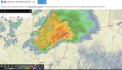
The boundary has become even more evident on the 18z hrrr 70-71 dewpoints with a sharp drop off of about 5-7 degrees just a mile or so northwest of it.
Navigation
Install the app
How to install the app on iOS
Follow along with the video below to see how to install our site as a web app on your home screen.
Note: This feature may not be available in some browsers.
More options
-
Welcome to TalkWeather! We see you lurking around TalkWeather! Take the extra step and join us today to view attachments, see less ads and maybe even join the discussion. CLICK TO JOIN TALKWEATHER
You are using an out of date browser. It may not display this or other websites correctly.
You should upgrade or use an alternative browser.
You should upgrade or use an alternative browser.
Severe WX March 26th-27th, 2023
- Thread starter JBishopwx
- Start date
tornado examiner
Member
I could see that one cell producing a mega long tracker….unlikely though since the highest ingredients aren’t in place yet
Lake Martin EF4
Member
So, Rolling Fork 2: Jesus Christ The Original Was Two Days Ago Boogaloo?I could see that one cell producing a mega long tracker
- Thread starter
- #184
The upgrade was scheduled a couple of years agoSeriously, why does a radar just oh suddenly require maintenance that just so happens to be when a major severe weather threat is present.
It never fails to occur.
tornado examiner
Member
Like I said. Unlikely
Wouldn't be surprising all things considered for a long track strong tornado given the right circumstances this evening.So, Rolling Fork 2: Jesus Christ The Original Was Two Days Ago Boogaloo?
southmdwatcher
Member
Why not, the ingredients were not REALLY in place across Georgia this morning either. The frontal boundaries are in place and so is the convergence across Louisiana and the numerous boundaries from the storms across Alabama and Georgia this morning. SIgnificant instability is already in place across the region.
Yeah this evening really does have potential for long trackers and significant tornadoes. Given the proximity and potential of a few cells to really lock on the boundary and utilize the shear enhancement.Why not, the ingredients were not REALLY in place across Georgia this morning either. The frontal boundaries are in place and so is the convergence across Louisiana and the numerous boundaries from the storms across Alabama and Georgia this morning. SIgnificant instability is already in place across the region.
Probably a pretty rough afternoon I'm afraid
southmdwatcher
Member
MLCAPE is up to 2500 to 3000 south of the front.
tornado examiner
Member
The HRRR is struggling incredibly bad this afternoon on handling the amount of instability. I mean it's off by about 1000j over portions of south Mississippi.
southmdwatcher
Member
ESRH as per from GREARTH is increasing to 200-400 m2/s2 along the area where the significant blowup of supercells has occurred in far eastern TX/western LA. The other parameters will only increase later
tornado examiner
Member
The storms in Texas are becoming outflow dominant…
Don’t let your guard down though…
(Winterset ef4)
Don’t let your guard down though…
(Winterset ef4)
Damage from the tornado in Georgia was significantly more intense than I imagined. Looks high end EF3 with even some relatively strong contextual damage. If it goes EF4 it would only be low end of course but unless a home is well built I doubt that would occur. Quite significant though really from an unexpected tornado. And in the lower likelihood scenario it is rated EF4 it would be the first time we had two EF4s from separate events within a week since 2020!
It's not often in the southeast you come across significant tornado days that are characterized as extreme instability/ low shear events..
Doesn't require extreme amounts of shear but when you are very good streamwise and have a lot of instability.. whoo boy
Doesn't require extreme amounts of shear but when you are very good streamwise and have a lot of instability.. whoo boy
southmdwatcher
Member
As per GREarth the MLCape is already at 2300 to 3300 across much of the target regions of Louisiana, Mississippi and AlabamaThe HRRR is struggling incredibly bad this afternoon on handling the amount of instability. I mean it's off by about 1000j over portions of south Mississippi.
That'll aid in violent updrafts with almost perfect streamwise shear. Reminds me of a simialr day that created a ef4 over Georgia a year or two ago. Not extreme shear but was darn good streamwise. (If my memory serves me correct that was the conditions can't remeber for sure my brain gets foggy on a lot of setups, pretty sure the synoptics were really good as well.) *CORRECTION , Looked up the data it had a lot more shear than I thought. So nvm about the analogy*As per GREarth the MLCape is already at 2300 to 3300 across much of the target regions of Louisiana, Mississippi and Alabama

TH2002
Member
- Messages
- 4,974
- Reaction score
- 11,116
- Location
- California, United States
- Special Affiliations
- SKYWARN® Volunteer
Looks like it might be trying to wrap up again as it crosses into LA. Not sure about the other parameters but it's certainly got plenty of CAPE to work with, bad things will happen if it decides to drop somethingI don’t like this