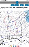
This is the 00z 3km nam. Im hoping this verifies but I doubt it will. I'd be the happiest person in the world if it does lol.

Follow along with the video below to see how to install our site as a web app on your home screen.
Note: This feature may not be available in some browsers.
That is a wicked deform band cranking on the sc / ga line, tooThis is the 00z 3km nam. Im hoping this verifies but I doubt it will. I'd be the happiest person in the world if it does lol.
View attachment 50440
WSW criteria is diff for between areas, what could be a winter storm watch or warning down south is a winter weather adv for a much more northern area or a winter weather adv translating to a winter storm warnings or blizzard warning for other areas. I find it really interestingWouldn't be surprised to see an extension of the watch down to about Charleston. Models are in pretty good agreement of at least 1-2" inches down here. That would not normally meet WSW criteria up north but I believe the local NWS offices make exceptions for such advisories when they are rare for the area, or would result in a higher impact for the area than others.
My memory may be bad but all the impactful snow events in B'ham I recall were all unexpected or last minute warnings as its unfolding.Not knowing until the day of an event or until the time in question happens can very be a thing when it comes to the weather.
Weather can be very complicated and is not as black and white as some people think. It’s tough.
Check out what Jason Simpson posted.
im curious to whether a winter weather advisory may get issued for Saturday by tommrow nightIts jinxed now !
Its either going to get better (increased snow chances) or it will completely disappear by tomorrow night. Will move back to east Georgial
im curious to whether a winter weather advisory may get issued for Saturday by tommrow night
I agree, I'm hoping for the former. But honestly im not getting my hopes up too much. Trying to stay realistic that it'll probably just be some flurries, even though I want a inch or two. Maybe tommorw it'll trend better lol.Its either going to get better (increased snow chances) or it will completely disappear by tomorrow night. Will move back to east Georgia

Yeah I think currently models are going to have a hard time with it, I think the snow for. Central Alabama is heavily reliant on instability which models are not going to pick up well onThe 6z models do not look as good (to my eyes anyway). However, BMX said that the setup looks more promising for certain areas... I realize this is a more of a "now-casting" scenario, Hoping flurries will make it a little further south to Dallas County. View attachment 50442
One thing that I have noticed on various models are these thin, narrow bands of snow...are these the "convective snow bands" that they are thinking will occur? This is from the RRFS model.Yeah I think currently models are going to have a hard time with it, I think the snow for. Central Alabama is heavily reliant on instability which models are not going to pick up well on
I think soOne thing that I have noticed on various models are these thin, narrow bands of snow...are these the "connective snow bands" that they are thinking will occur? This is from the RRFS model.
I edited my comment...I meant "Convective."...autocorrectI think so
I like the look of that model...a nice snow band coming through central Alabama all the way through Dallas County. Hopefully trending in the right direction!Based on the hrrr I wouldn't be surprised for the winter storm watches to be extended west to closer to the Alabama state line in Georgia. 12z Hrrr has decent snow all the way to the line. And the model also has better snow chances for Alabama. Maybe we are seeing a uptick?
The 12z HRRR keeps trending the 700mb low more to the west and has so over the previous 4 runs which is good news for snow lovers in Georgia and Alabama.Based on the hrrr I wouldn't be surprised for the winter storm watches to be extended west to closer to the Alabama state line in Georgia. 12z Hrrr has decent snow all the way to the line. And the model also has better snow chances for Alabama. Maybe we are seeing an uptick?
The snow ratio is also like 20-25:1 so the forecast snow totals on the hrrr is underdone.I like the look of that model...a nice snow band coming through central Alabama all the way through Dallas County. Hopefully trending in the right direction!