Navigation
Install the app
How to install the app on iOS
Follow along with the video below to see how to install our site as a web app on your home screen.
Note: This feature may not be available in some browsers.
More options
-
Welcome to TalkWeather! We see you lurking around TalkWeather! Take the extra step and join us today to view attachments, see less ads and maybe even join the discussion. CLICK TO JOIN TALKWEATHER
You are using an out of date browser. It may not display this or other websites correctly.
You should upgrade or use an alternative browser.
You should upgrade or use an alternative browser.
invest 93L (40/40)
- Thread starter IdaliaHelene
- Start date
Right. I'm kinda surprised the forecast models aren't more aggressive with the total rainfall amounts because you are definitely going to have PWAT values surging to near or exceeding 3 inches. I mean I understand this isn't organized yet, but still.Thank you mods/admins. Your work is much appreciated.
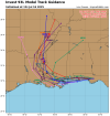
Looks like the latest spaghetti models keep this mostly onshore. Seems appropriate with how far north that swirl was/is. Still, I dread the atmospheric rivers this will be able to pull up out of the gulf. Expecting SE flooding on this track.
View attachment 45130
Exactly.Right. I'm kinda surprised the forecast models aren't more aggressive with the total rainfall amounts because you are definitely going to have PWAT values surging to near or exceeding 3 inches. I mean I understand this isn't organized yet, but still.
Couple of things about this one still giving me pause, even on this track.
1. The ground (where it isn't swamp already) is very saturated in the panhandle. There may not be a whole lot of difference between land and sea. Brown ocean effect.
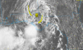
2. I'm not liking how much influence this low is already throwing around. That's a healthy looking spin.
3. Dry air on it's path. Simply put - "there ain't any".

Obviously one would need a more southerly track for any RI or major shenanigans, but I'm not writing off this one having surprises and outsized impacts. The recent rain rates have been absurd - 11 inches in 4 hours in one spot in FL near Lakeland under one of these thunderstorms.
I mean to be honest the 12z UKMET, ICON, and Canadian from yesterday makes the most sense rainfall wise.
Attachments
LOL... that very promising surface spin just spun up into S GA.

 weather.cod.edu

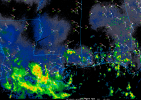
COD-NEXLAB : Dual-Pol Radar for JAX
Dual-Pol NEXRAD Data for provided by College of DuPage Meteorology (NEXLAB)
With that surface circulation all the way up in SW GA, I just don't see it doing much. Path is just way too far north for shenanigans. It will be a good forcing mechanism for afternoon storms, but as far as tropical cyclones go, it's not going to be up to much, IMO.93L may indeed surprise us;
Looks like it's just gonna keep scraping along the coast, so while it definitely will definitely keep things rainy on the Gulf Coast, not foreseeing much in the way of robust development. Models still have something developing further out in the Gulf, but I'm skeptical. Still, tropics can surprise, so never write anything off completely.With that surface circulation all the way up in SW GA, I just don't see it doing much. Path is just way too far north for shenanigans. It will be a good forcing mechanism for afternoon storms, but as far as tropical cyclones go, it's not going to be up to much, IMO.
Surface circulation somewhere in coastal MS over to Lake Pontchartrain. Rainy day in NOLA. Now this system begins its turn inland and drags gulf moisture up into LA and MS. Glad this one has been a non-event. Hopefully that continues, but I'd certainly keep an eye on rain rates and areas that get trained over for flooding. There's a pretty good bit of dry mid level air to the NW, so hopefully that will keep down some of the totals.


Never really lived, TBH. Only ever really existed in the hype machine.
wx_guy
Member
- Messages
- 1,202
- Reaction score
- 4,315
- Location
- United States
- HAM Callsign
- KO4ZGH
- Special Affiliations
- SKYWARN® Volunteer
- ARRL Member
And this is why we don't make threads for questionable Invests? haha
@WesL @MichelleH this invest is gone.


