Thank you mods/admins. Your work is much appreciated.
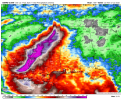
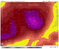
Looks like the latest spaghetti models keep this mostly onshore. Seems appropriate with how far north that swirl was/is. Still, I dread the atmospheric rivers this will be able to pull up out of the gulf. Expecting SE flooding on this track.

Looks like the latest spaghetti models keep this mostly onshore. Seems appropriate with how far north that swirl was/is. Still, I dread the atmospheric rivers this will be able to pull up out of the gulf. Expecting SE flooding on this track.