• Welcome to TalkWeather!
    We see you lurking around TalkWeather! Take the extra step and join us today to view attachments, see less ads and maybe even join the discussion.
    CLICK TO JOIN TALKWEATHER

Invest 92L/Hurricane Isaias Severe WX

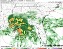
This is not something I'd rely on but if you want to... You can check out the hurricane models (HAFS or etc) radar to get a early depiction of what it may look regarding the tornado threat and the outer bands. Your main CAMs are key but just if you want a early look ahead at this threat.
 
Looks like a pretty classic tropical tornado event for MS/AL/GA if this storm ends up evolving in the general fashion models suggest. Tropical Storm Lee in 2011 gave western Georgia a decent smattering of tornadoes from remnant storm bands, and followed a fairly similar track.
floop-ecmwf_full-2026100600.prateptype_cat_ecmwf-imp.us_se.gif
 
The tornado threat in and of itself from this looks to be fairly classic.

Some thoughts I have regarding this is that there are some factors that could further enhance the tornado threat. Namely the fact that this appears to make landfall in an area with a good amount of shear, and a stronger EML/Dry punch. This would likely allow for mini-supercells in the outer bands to produce a more significant tornado threat rather than spamming weak and brief spin ups for a little while

Things could change, but seems like a fairly interesting setup.
 
Models are beginning to come in and confirm my initial suspicion. Likely to be Isaias peaks around C2/C3 in the gulf but dry air rips it apart. What does that mean? Dry air aiding and helping the tornado risk significantly. Beryl was decently weak within landfall and still produced a major TC induced outbreak. Not to say that will happen but it will make this risk a bit more intense in nature than usual.
 
In my memory, it's pretty unusual for SPC to highlight an area beyond day 4 for strictly tropical tornadoes. Usually there's too much uncertainty around whether a particular landfall will come with the necessary ingredients for a substantial threat vs. just sporadic, isolated occurrences within the bands of the right-front quadrant.
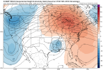
 
In my memory, it's pretty unusual for SPC to highlight an area beyond day 4 for strictly tropical tornadoes. Usually there's too much uncertainty around whether a particular landfall will come with the necessary ingredients for a substantial threat vs. just sporadic, isolated occurrences within the bands of the right-front quadrant.
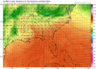
To back up your statement here. Trey in his forecast video talked about how this setup would favor a more elevated tornado threat. Similar to Milton (but was saying maybe not to that extreme).

Reading the write up on the day 5 Spc discussion talks about supercells oriented east to west possibly after initially being elevated when moving inland. I definitely don’t envy mobile or Pensacola NWS in warning this event. I’m also curious to how far inland a substantial tornado threat could materialize due to the straight northerly track of the low pressure.
 
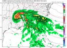
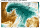
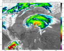
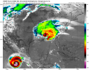
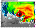
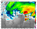
Throwing the euro and some maps out there that look good. Check out the mid levels dry air punching in. And the low level moisture. As well as simulated radar. A seriously large area from Alabama to Georgia could be dealing with a low topped supercell nightmare.


IMG_0536.pngIMG_0535.pngIMG_0534.pngIMG_0533.png
 
Throwing the euro and some maps out there that look good. Check out the mid levels dry air punching in. And the low level moisture. As well as simulated radar. A seriously large area from Alabama to Georgia could be dealing with a low topped supercell nightmare.


View attachment 55139View attachment 55140View attachment 55141View attachment 55142
Yeah, I dunno that the tornado threat will necessarily be relegated to the coast here, as is often the case with landfalling TCs. That said, MOB & TAE are probably in for a doozy from this one.
 
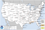
15% risk for day 4. Almost covering the entire southern half of Alabama. With explicit mention of a few supercells and a accompanying tornado risk
 
Back
Top