• Welcome to TalkWeather!
    We see you lurking around TalkWeather! Take the extra step and join us today to view attachments, see less ads and maybe even join the discussion.
    CLICK TO JOIN TALKWEATHER
  • Current Tropical Systems
    Erin

Hurricane Erin

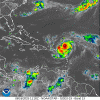
An EWRC is underway according to the NHC. That said, in the same advisory they stated that Erin would likely pull off C5 before it really sets in. Exact wording:
The aircraft, along with land-based radar data from Sint
Maarten, report that an outer eyewall is starting to form. However,
this has yet become apparent in the aircraft wind data.
...
The development of the outer eyewall suggests that rapid
intensification should end during the next several hours. However,
Erin is expected to reach category 5 status before this occurs, and
the new intensity forecast now calls for a peak intensity of 145 kt.
 
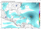
ALL of the models drastically underestimated the RI (as is typical, the models suck at RI), but to my earlier points in this thread, the AI models (both the Euro and the Google DeepMind) AMAZINGLY underestimated where Erin is now, using their forecasts from 24 hours ago valid at 8 AM this morning. The AI Models have a really hard time with edge events like this, and they probably shouldn't be trusted at all for Rapid Intensification, barring model improvements.


1755356964385.png


1755357052149.png
 
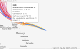
The 11 AM forecast calls for it to be at 20.1 N at 8 PM tonight. Let's mark this down and see how close it comes to that latitude.

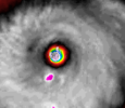
I mean I won’t say they will be wrong getting to that latitude, but the trend is not favoring that looking at it currently. I think this could be stronger than 165. In fact I won’t be surprised if it pulls a Dorian in strength or Allen from 1980. No sign of an eye wall replacement cycle and the eye is considered one of the driest on record.
 
I mean I won’t say they will be wrong getting to that latitude, but the trend is not favoring that looking at it currently. I think this could be stronger than 165. In fact I won’t be surprised if it pulls a Dorian in strength or Allen from 1980. No sign of an eye wall replacement cycle and the eye is considered one of the driest on record.
There is a sign of an EWRC, though it could be like Irma and abort it.
 
ALL of the models drastically underestimated the RI (as is typical, the models suck at RI), but to my earlier points in this thread, the AI models (both the Euro and the Google DeepMind) AMAZINGLY underestimated where Erin is now, using their forecasts from 24 hours ago valid at 8 AM this morning. The AI Models have a really hard time with edge events like this, and they probably shouldn't be trusted at all for Rapid Intensification, barring model improvements.


View attachment 46084


View attachment 46085
And that’s why you can’t trust the Euro for no development out of the wave by the Cape Verdes that will come off in a few days.
 
And that’s why you can’t trust the Euro for no development out of the wave by the Cape Verdes that will come off in a few days.
There is a wave offshore of Africa just to the south of the Dakar panhandle that has some circulation spin to it. Hard for me to tell if it is low-level or mid-level.
 
And that’s why you can’t trust the Euro for no development out of the wave by the Cape Verdes that will come off in a few days.
Yep, admittedly I don’t know much about this topic, but it really seems to me that while the GFS tends to overblow hurricanes 200+ hours out, the Euro just doesn’t develop them at all and is pretty bad at it, even when the invest consolidates fully
 
Back
Top