
CheeselandSkies
Member
Tornado reported with the storm north of Branson, MO (public report, so somewhat suspect).
Follow along with the video below to see how to install our site as a web app on your home screen.
Note: This feature may not be available in some browsers.

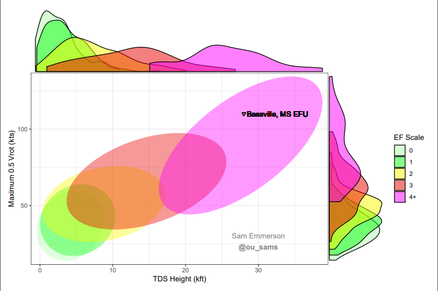
Was about to post that, and it is visible extremely high up in the storm as well. Isn't there a chart based on how high up debris are lofted that correlates really well with the strength of the tornado?

Caruthersville will be in the path if this thing holds itself together for much longer.
I was just going to mention the possibility of Caruthersville being hit and its previous tornado... and that we could have another Tri-State (or even quad-state!) tornado if this thing holds together.
I can't do anything watch this tornado... nothing else on the radars looks anything like this even with the states having tornado warningsI was just going to mention the possibility of Caruthersville being hit and its previous tornado... and that we could have another Tri-State (or even quad-state!) tornado if this thing holds together.
Looking at the latest screenshot they even look similar. Deja vu.

