• Welcome to TalkWeather!
    We see you lurking around TalkWeather! Take the extra step and join us today to view attachments, see less ads and maybe even join the discussion.
    CLICK TO JOIN TALKWEATHER

Severe WX December 10 & 11, 2021 Severe Threat

Based on radar I knew there were probably several violent tornadoes taking numerous lives. Like I said I was worrying it was going to surpass the April 27, 2011 super tornado outbreak in terms of injuries and fatalities because of the time of night the tornadoes were happening.
Seeing the debris signatures on radar was just heartbreaking to see. We all knew those tornados were tearing lives apart and the only thing we could do was watch the radar.
 
Still probably the craziest tornado event I've tracked live on this forum, since April 27, 2011 was a few years before I joined and I was out chasing on March 31, 2023 and April 26 of this year. Although, Easter 2020 comes close.

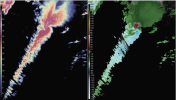
@andyhb called the incipient monster supercell when it was still a number of kidney-bean updrafts gradually amalgamating just northeast of Little Rock. I knew it was gonna be big trouble when it displayed a BWER strongly reminiscent of the Cullman supercell on ABC 33/40's radar just prior to the famous tornado-on-skycam sequence.

Probably most dramatic reflectivity BWER I've seen since the formative stages of the Cullman tornado of 2011.

NQA_0031.png
 
Last edited:
And even 3 years later, this still remains in my opinion one of the all time most haunting tornado videos you’ll ever see. The video doesn’t even truly capture the horror Bremen was facing at this time. The roar, lightning, and sheer size of that beast is still something I have trouble comprehending.
 
Gotta say, there was lots of great local coverage from the affected areas that night (was watching multiple livestreams as the storm moved between markets), but WPSD in Paducah with Trent Okerson and Noah Bergren really knocked it out of the park. Best I've seen since 33/40 on 4/27/11.


They did a truly outstanding job that night and likely saved so many lives that easily could have been lost without good news coverage.
 
This is the exact failure mode I was expecting. Context-based EF5 is no longer a thing. This establishes it.
(until 4 days ago) lol.

Jeez. Coming back to this after it ends finally and just, seeing how upset and angry everyone was.
Wow…what a run,
That whole surveying run in the week following this event just led to an absolute sh*show on this site.
 
Last edited:
No, it's Quad State. Not even a year after it happened, Port Arthur has already seemingly been forgotten, but Quad State was FAR stronger, FAR longer and FAR more notorious overall.
Well, that is because of what the tornado hit. If we actually look at the "supercell" specifically I think the Port Arthur supercell meteorologically is more impressive.
 
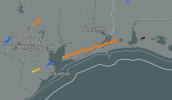
I mean look at this inflow tail on Port Arthur just sucking in all the moisture from the gulf. This thing generated tornadoes in someway for almost 3 hours at very high intensity too.View attachment 47130
Not necessarily the main topic at hand, but i can see your argument here given that such well organised and top end supercells near the Gulf are pretty rare. Crapvection usually chokes most out, but this had very strong moisture feeding into it and a confluence band of nudgers. Both supercells are very impressive in their own right
 
I mean look at this inflow tail on Port Arthur just sucking in all the moisture from the gulf. This thing generated tornadoes in someway for almost 3 hours at very high intensity too.View attachment 47130
I understand that Port Arthur is impressive - especially for the time of year. But to be honest having produced 3-4 tornadoes (hard to determine what was continuous over water etc) - one of which was intense, doesn't compare to many other supercells this decade let alone the Quad - State Supercell.
1760196090073.png

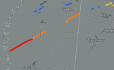
The supercells on March 14th this year were easily that caliber or higher producing 100s of miles of EF3 and EF4 track length in cases. Even the Jan 12th 2023 supercell produced miles and miles of EF2/EF3 track length (including likely violent intensity) across AL and GA after it became embedded.

1760196294013.png1760196339871.png

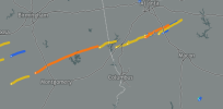
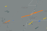
Rolling Fork supercell deserves a mention as well, having dropped 3 EF3+ tornadoes across long path lengths. Or the supercell on March 31st 2023 which produced 3 high end EF3s with long track lengths

1760196445660.png1760196511560.png

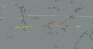
Even the TN March 3rd 2020 supercell is pretty forgotten yet was high-end producing EF2+ tornadoes for hundreds of miles. Bassfield was impressive too.

1760196833666.png1760196929491.png


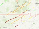
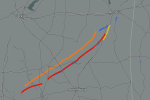
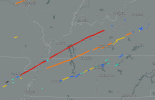
And then of course Dec 10th 2021. I think this is probably the unparalleled event of the 2020s in terms of consistently high-end, extremely long track tornadoes.

1760196672840.png

Even without the main quad-state supercell, you could make an argument for the second supercell which tracked from TN into KY to be the supercell of the decade especially given there is good evidence of Bowling Green being EF4 and I've seen some suggestions of Dresden TN being EF4 intensity too.

I'm not trying to shut down your suggestion by the way - every opinion is valid and worth considering. But I think it goes to show how impressive the 2020s have been for tornadic activity that multiple events have had very long tracked supercells that consistently drop EF3+ tornadoes.
 
I understand that Port Arthur is impressive - especially for the time of year. But to be honest having produced 3-4 tornadoes (hard to determine what was continuous over water etc) - one of which was intense, doesn't compare to many other supercells this decade let alone the Quad - State Supercell.
View attachment 47167

The supercells on March 14th this year were easily that caliber or higher producing 100s of miles of EF3 and EF4 track length in cases. Even the Jan 12th 2023 supercell produced miles and miles of EF2/EF3 track length (including likely violent intensity) across AL and GA after it became embedded.

View attachment 47168View attachment 47169

Rolling Fork supercell deserves a mention as well, having dropped 3 EF3+ tornadoes across long path lengths. Or the supercell on March 31st 2023 which produced 3 high end EF3s with long track lengths

View attachment 47170View attachment 47171

Even the TN March 3rd 2020 supercell is pretty forgotten yet was high-end producing EF2+ tornadoes for hundreds of miles. Bassfield was impressive too.

View attachment 47173View attachment 47174


And then of course Dec 10th 2021. I think this is probably the unparalleled event of the 2020s in terms of consistently high-end, extremely long track tornadoes.

View attachment 47172

Even without the main quad-state supercell, you could make an argument for the second supercell which tracked from TN into KY to be the supercell of the decade especially given there is good evidence of Bowling Green being EF4 and I've seen some suggestions of Dresden TN being EF4 intensity too.

I'm not trying to shut down your suggestion by the way - every opinion is valid and worth considering. But I think it goes to show how impressive the 2020s have been for tornadic activity that multiple events have had very long tracked supercells that consistently drop EF3+ tornadoes.
Yeah, this is a quality post. I agree that 12/10/21 is the most intense Winter supercell, and the rest were fairly impressive but you just don't get a 100 mile+ EF4 all that often, and plus 3/14 may actually compete for that place too. Truly absurd.
 
Back
Top