• Welcome to TalkWeather!
    We see you lurking around TalkWeather! Take the extra step and join us today to view attachments, see less ads and maybe even join the discussion.
    CLICK TO JOIN TALKWEATHER

Severe WX April 3-6 Severe weather

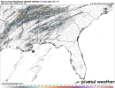
12Z CAM suite UH streaks for Sunday. All CAMs except the NAM 3km locking onto a bowing segment jutting out ahead of the rest of the MCS/QLCS, and potentially resulting in a boundary across northern Alabama and Georgia, along which tornadic potential might maximize. A fairly robust damaging wind and QLCS tornado threat is depicted on CIPS and a slight risk-level risk is depicted on CSU's probabilities; hail shouldn't be an issue. Thankfully, I don't expect it'll be anything like what areas further west have been dealing with for days on end, but kinematics will be strong, so any storms that maintain intensity could definitely put down tornadoes and straight-line winds.
1743869970598.png1743869973863.png1743869977333.png1743869981085.pngfloop-hrrr-2025040512.refcmp_uh001h.us_se.gif
39229_e4c3ca3f07b6c80cc4479b0be76a9c30.gif
floop-hrwarw-2025040512.refcmp_uh001h.us_se.giffloop-hrwnssl-2025040512.refcmp_uh001h.us_se.gif1743870652056.png1743870657701.png
 

Attachments

  • floop-nam4km-2025040512.refcmp_uh001h.us_se.gif
    floop-nam4km-2025040512.refcmp_uh001h.us_se.gif
    2.9 MB · Views: 0
12Z CAM suite UH streaks for Sunday. All CAMs except the NAM 3km locking onto a bowing segment jutting out ahead of the rest of the MCS/QLCS, and potentially resulting in a boundary across northern Alabama and Georgia, along which tornadic potential might maximize. A fairly robust damaging wind and QLCS tornado threat is depicted on CIPS and a slight risk-level risk is depicted on CSU's probabilities; hail shouldn't be an issue. Thankfully, I don't expect it'll be anything like what areas further west have been dealing with for days on end, but kinematics will be strong, so any storms that maintain intensity could definitely put down tornadoes and straight-line winds.
View attachment 39206View attachment 39207View attachment 39208View attachment 39209View attachment 39210
39229_e4c3ca3f07b6c80cc4479b0be76a9c30.gif
View attachment 39212View attachment 39213View attachment 39217View attachment 39218
Uh oh.. you got my attention at “boundary “
 
12Z CAM suite UH streaks for Sunday. All CAMs except the NAM 3km locking onto a bowing segment jutting out ahead of the rest of the MCS/QLCS, and potentially resulting in a boundary across northern Alabama and Georgia, along which tornadic potential might maximize. A fairly robust damaging wind and QLCS tornado threat is depicted on CIPS and a slight risk-level risk is depicted on CSU's probabilities; hail shouldn't be an issue. Thankfully, I don't expect it'll be anything like what areas further west have been dealing with for days on end, but kinematics will be strong, so any storms that maintain intensity could definitely put down tornadoes and straight-line winds.
View attachment 39206View attachment 39207View attachment 39208View attachment 39209View attachment 39210
39229_e4c3ca3f07b6c80cc4479b0be76a9c30.gif
View attachment 39212View attachment 39213View attachment 39217View attachment 39218
HRRR takes that bowing segment right over me head
 
DAY 1 CONVECTIVE OUTLOOK
NWS STORM PREDICTION CENTER NORMAN OK
1140 AM CDT SAT APR 05 2025

VALID 051630Z - 061200Z

...THERE IS A MODERATE RISK OF SEVERE THUNDERSTORMS ACROSS PARTS OF
EASTERN ARKANSAS...WESTERN TENNESSEE...AND NORTHERN MISSISSIPPI...

..SUMMARY

SEVERE STORMS, CAPABLE OF PRODUCING DAMAGING WIND GUSTS, LARGE HAIL
AND SEVERAL TORNADOES ARE EXPECTED FROM THE SABINE RIVER VALLEY
NORTHEASTWARD INTO THE MID-SOUTH AND LOWER MISSISSIPPI AND OHIO
VALLEYS. STRONG TORNADOES, VERY LARGE HAIL, AND SEVERE WIND GUSTS
ARE ALL POSSIBLE.

..EAST TX/ARKLATEX TO LOWER MISSISSIPPI VALLEY

SEVERE STORMS CONTINUE TO INCREASE THROUGH LATE MORNING INTO MIDDAY
ESPECIALLY ACROSS PARTS OF ARKANSAS, WITH THE UPSCALE-GROWING
MCS/BOW ECHO NEAR/NORTHEAST OF THE LITTLE ROCK AREA AS OF 1130 CDT.
A 60 KT WIND GUST WAS RECENTLY MEASURED AT KLRF/NORTH LITTLE ROCK.
THIS BOWING MCS SHOULD CONTINUE TO FAVOR THE ZONE NEAR/IMMEDIATELY
NORTH OF THE EFFECTIVE BOUNDARY THAT PRECEDES IT (ROUGHLY PARALLEL
TO I-40), LIKELY TAKING IT INTO WESTERN TENNESSEE THIS AFTERNOON,
POTENTIALLY NEAR THE MEMPHIS METRO VICINITY. SEE MESOSCALE
DISCUSSION 411 FOR ADDITIONAL DETAILS. A MODERATE RISK UPGRADE HAS
BEEN INTRODUCED FOR THIS SCENARIO, AS WELL AS POTENTIAL
SEMI-DISCRETE WARM-SECTOR DEVELOPMENT LATER THIS AFTERNOON TO ITS
SOUTH.

WITHIN THE AXIS OF A STRONG LOW-LEVEL JET (SOUTH-SOUTHWESTERLY 50-60
KT ACROSS THE ARKLATEX AND ARKLAMISS), SUPERCELL LONGEVITY/TORNADO
POTENTIAL WILL BE MAXIMIZED WITH ANY DIURNAL WARM-SECTOR DEVELOPMENT
THAT OCCURS AWAY FROM (EAST-SOUTHEAST OF) THE OUTFLOW-REINFORCED
EFFECTIVE FRONT, ALTHOUGH THE EXTENT OF THAT MY TEND TO BE SOMEWHAT
CURBED BY PERSISTENT CLOUD COVER AND SEMI-MILD MID-LEVEL
TEMPERATURES (-9 OR -10C AT 500MB) INTO THE WARM SECTOR.
ADDITIONALLY, DEEP-LAYER SHEAR VECTORS WILL BE LARGELY PARALLEL TO
THE EFFECTIVE FRONT REGIONALLY, SUGGESTIVE OF A MIXED CONVECTIVE
MODE INCLUDING HP SUPERCELLS/SMALLER-SCALE BOWS IN CLOSE PROXIMITY
TO THE CONVECTIVELY MODIFIED EFFECTIVE FRONT. THE FRONT WILL BECOME
MORE EAST/SOUTHEASTWARD-PROGRESSIVE LATER THIS AFTERNOON AND TONIGHT
ACROSS EAST/SOUTHEAST TEXAS, SOUTHERN ARKANSAS, AND LOUISIANA.
OVERALL, SOME TORNADOES ARE EXPECTED REGIONALLY, A FEW OF WHICH
COULD BE STRONG, ASIDE FROM DAMAGING WINDS AND ISOLATED LARGE HAIL.

..MID-SOUTH INTO THE TN/OH VALLEYS

FARTHER NORTH, THE BOUNDARY WILL BE LESS PROGRESSIVE THROUGHOUT THE
MORNING/EARLY AFTERNOON, PARTICULARLY NORTH OF A WEAK LOW CURRENTLY
OVER NORTHEAST TEXAS. THE BOUNDARY WILL LIKELY SHARPEN DURING THIS
TIME, BEFORE THEN BECOMING MORE PROGRESSIVE ONCE AGAIN AS THE
CONVECTIVELY AUGMENTED SHORTWAVE TROUGH CURRENTLY MOVING INTO
WESTERN OKLAHOMA PROGRESSES INTO THE REGION. THIS WILL LIKELY RESULT
IN A BOWING LINE SEGMENT WITH DAMAGING GUSTS AS THE PRIMARY SEVERE
RISK. HOWEVER, GIVEN THE STRENGTH OF THE LOW-LEVEL FLOW, SOME
EMBEDDED TORNADO POTENTIAL EXISTS AS WELL.

..GUYER/LYONS.. 04/05/2025
 
Back
Top