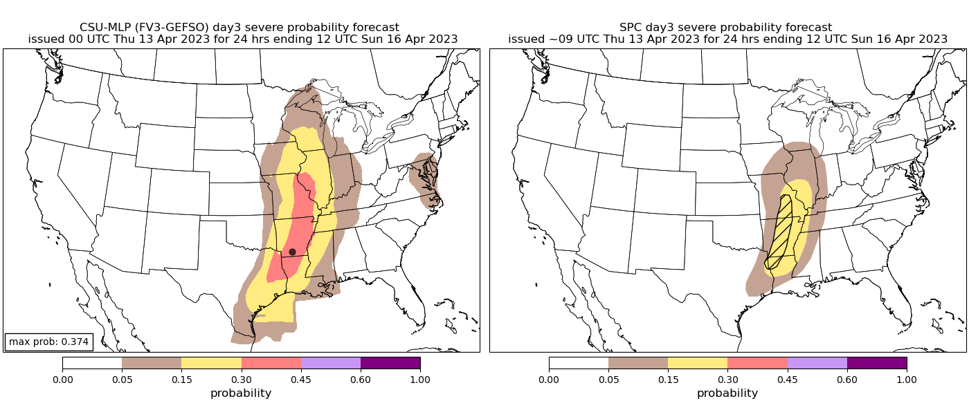
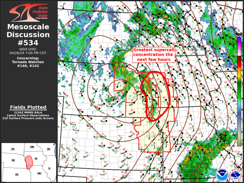
THERE IS A SLIGHT RISK OF SEVERE THUNDERSTORMS OVER MUCH OF
CENTRAL KANSAS...SOUTHEAST NEBRASKA...AND FAR NORTHERN OKLAHOMA...
...SUMMARY...
Severe thunderstorms capable of producing large hail and damaging
winds are most likely from late afternoon through evening from
central Kansas into southeast Nebraska.
...Synopsis...
A large-scale upper trough will move east across the Rockies today,
with 30-40 kt midlevel southwesterlies spreading into the Plains.
Meanwhile, an upper low will move northeastward from the TN Valley
toward the Appalachians, providing cool air aloft and maintaining a
belt of stronger winds aloft across parts of the Southeast.
At the surface, low pressure will translate south from western KS
into the TX Panhandle as a cold front arrives from the north. A
pre-frontal trough will extend northeastward toward MN and WI, with
more southerly flow at 850 mb aiding moisture transport northward to
meet the front. A dryline will extend from southwest KS across far
western OK and into northwest TX for much of the day, with the
hot/deeply mixed air nosing into central KS by late afternoon.
The combination of cool midlevel temperatures/steep lapse rates and
dewpoints rising into the mid to upper 50s should result in a
concentrated area of severe today later today, centered over Kansas.
...Central Plains...
The air mass over the warm sector will be capped for much of the
day, as moisture returns resulting in a plume of strong instability
from northwest OK into central KS. Forecast soundings late in the
afternoon show impressive instability profiles with steep midlevel
lapse rates over 8.0 C/km. As heating occurs near the low and
dryline, the cap is likely to break over central KS, with storms
likely developing near 21Z. Storms may develop rather quickly, with
very large hail possible initially. With time, cells may merge into
clusters, propagating rapidly northeastward across southeast NE and
parts of northeast KS. A few significant severe wind gusts are
forecast given ample instability and steep lapse rates. Capping will
quickly limit eastern and southern extend of the threat, but a tail
end storm or southward-moving outflow producing severe gusts may
spread into northern OK during the evening as well as across the
Kansas City area before completely dying out.
...Carolinas...
Daytime heating beneath relatively cool midlevel temperatures with
the upper low will result in areas of MLCAPE over 500 J/kg across
the region, with pockets of 1000+ J/kg across eastern NC and
southeast VA where dewpoints will remain in the mid 60s F. In the
wake of early day activity associated with warm advection, heating
of the moist air mass and sufficient instability with a very weak
lee trough will lead to at least isolated daytime storms, some of
which may produce locally damaging wind gusts and hail during the
peak heating hours. Veering winds with height, although not strong,
may support cellular activity, further supporting a hail threat.
..Jewell/Squitieri.. 04/14/2023


