• Welcome to TalkWeather!
    We see you lurking around TalkWeather! Take the extra step and join us today to view attachments, see less ads and maybe even join the discussion.
    CLICK TO JOIN TALKWEATHER

Severe WX April 11th-13th, 2020 Severe Weather Threat

Wow, I expected a few issues in GA/SC, but nothing like what I woke up to. Incredible. CC is such an indispensable tool in events like this one.

Still interested to know what prevented MS/AL from having a larger event than they did. What were the factors that held the event back? Especially as it pertained to the supercells that did form? We had two major supercells that looked amazing for awhile and then after that, thankfully, they never could re-establish themselves. What happened?
I think we didn’t have enough instability for the extreme shear we had across Central AL. That rain mass cooled enough of the atmosphere. We did have enough instability to keep the storms surface based but the extreme shear kept tearing apart the updrafts. That’s why you’d see them look good and then poof in 15 minutes.
 
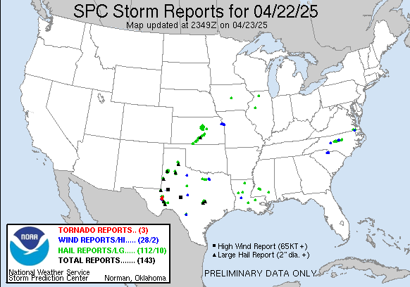
Some of these blue dots will likely change to red across MS/AL/GA/SC once things get investigated by the NWS offices. You can see a lot of the mesocyclones were long tracking per this map. They just cycled very often dropping and lifting outside of the major MS tornadoes down south.

yesterday.gif
 
Yay, we have power again and I finally got my hot spot to work! (Internet is still down.) Seeing this morning just how lucky we were. The gas station a mile away was trashed and transformers all over the road there last night. This morning we see numerous limbs in the front yard and one of the trees is partially debarked. We heard the roar while we were taking shelter but I kept telling my son (who's terrified of tornadoes) that it was just wind. Neighbor across the street has their flag pole laying twisted in their front yard. I think it went over the house...again. This keeps happening. But thank you Lord for sparing us again! Praying for all those everywhere who were hit. One of my son's friends lost part of her home. :(
 
I believe one of the biggest mitigating factors in this event was the earlier than expected veering of the winds in S AL. The reduced surface level convergence makes perfect sense as to why those first two storms with violent tornadoes abruptly died in almost the same place, seeming to go elevated and rapidly move north. The cells that were already further north out of the more veered winds went into the tuscaloosa and brimingham areas, and there were several QLCS spinups in that area.

Further south, I believe the Cap didn't break in the LA panhandle area, and that probably contributed to the storms growing upscale before they really rooted in the explosive surface parcel. As a result, the storms became a QLCS very quickly.
 
Those storms in western Alabama that produce widespread wind damage and the tornado were not elevated...given the extensive wind damage and tornado tells me they were surface based. Our winds stayed backed through the event in Tuscaloosa. We had such extreme shear in place the updrafts got ripped apart and couldn’t sustain themselves. Effective SRH was >800m2/s2.
 
Those storms in western Alabama that produce widespread wind damage and the tornado were not elevated...given the extensive wind damage and tornado tells me they were surface based. Our winds stayed backed through the event in Tuscaloosa. We had such extreme shear in place the updrafts got ripped apart and couldn’t sustain themselves. Effective SRH was >800m2/s2.
I was referring to the stuff in S LA and offshore that never made it into C AL, but just went through southern AL as a messy QLCS until it reached GA and became more cellular in nature. Central and Northern AL are different stories entirely.

To be clear, southern AL became veered quite a bit earlier than was expected. It was mentioned by a met earlier in this thread as well.
 
Boaz with damage that looks >EF2. I’m not sure what they can rate just tree damage with nothing else but I would potentially say the Lake Tuscaloosa tornado was borderline strong. Carbon Hill had mangled mobile homes. Other impressive signatures near Sand Mountain. I’m not sure why people and some TV mets in the Birmingham market were declaring the threat over for Northern and Central AL.
 
Last edited:
Soso damage

Video from the Soso area

Obviously that is just one area of damage, but nothing in that video screams over EF-3 to me. Solid damage to be sure, but in that particular area I don't see anything that would indicate a higher damage rating. I also wonder what kind of DIs are were in the path of that tornado at its peak? May not have hit anything that would support a violent rating. I'm sure the tree damage is amazing, but thankfully it's not a densely populated area so there's not a huge number of structures.
 
Obviously that is just one area of damage, but nothing in that video screams over EF-3 to me. Solid damage to be sure, but in that particular area I don't see anything that would indicate a higher damage rating. I also wonder what kind of DIs are were in the path of that tornado at its peak? May not have hit anything that would support a violent rating. I'm sure the tree damage is amazing, but thankfully it's not a densely populated area so there's not a huge number of structures.

I thought the same. Obviously not excited to see any damage, but I was happy to see it wasn’t worse than that! Hopefully the other areas there fared just as well.
 
This is from Upson Co., GA (near Thomaston).


It appears to have pivoted around the power pole with the support strand of the triplex keeping it attached. Notice the bent mast and attached power drop under tension. This would have been very interesting to witness and definitely a case of "just right". Not enough force to destroy the house, or break the mast or triplex - but enough to lift/push the house around.
 
From NWS Morristown:

Preliminary tornado survey in Eastern Chattanooga indicates at least an EF-2 tornado near the Hamilton Place mall. We're continuing to gather more information so this may be updated. Important to stay out of this area if possible due to allow emergency services to work.​
 
Back
Top