AJS
Member
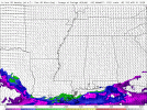
For what day?The enviroment over Oklahoma and Nebraska in the 18z nam is just absurd. If any supercell's can use that, it'll be a nasty sight
Follow along with the video below to see how to install our site as a web app on your home screen.
Note: This feature may not be available in some browsers.
For what day?The enviroment over Oklahoma and Nebraska in the 18z nam is just absurd. If any supercell's can use that, it'll be a nasty sight
Tomorrow, most of those areas aren't included in the day 3.For what day?
Tuesday is the only day those states are under the gunFor what day?

18z NAM is absolutely nasty on Wednesday across a large area, particularly in the Mid South and Lower Ohio Valley from 21z through 03z (and probably longer).
I second this…Andy, are you seeing any failure modes for Wednesday? Capping looks pretty decent until storms initiate and I don't see crapvection being an issue. Forcing looks pretty decent as well, should support supercells with some a few pockets of linear development but not enough to turn it into a derecho. Lapse rate look more than sufficient and quite robust.
There's a number of potential failure modes. The biggest one is early convection and outflow overrunning the warm sector. Another may be boundary orientation (which would be mitigated if a pre-frontal trough is present) and the fact that the primary wave is leaving the warm sector behind in the afternoon (which could be mitigated if there are any embedded shortwaves in the jet). A third may be a larger degree of mixing of the boundary layer that could create unfavorable LCL heights further south for a time.Andy, are you seeing any failure modes for Wednesday? Capping looks pretty decent until storms initiate and I don't see crapvection being an issue. Forcing looks pretty decent as well, should support supercells with some a few pockets of linear development but not enough to turn it into a derecho. Lapse rate look more than sufficient and quite robust.
What are your thoughts on tomorrow? It is certainly starting to get some serious hype.There's a number of potential failure modes. The biggest one is early convection and outflow overrunning the warm sector. Another may be boundary orientation (which would be mitigated if a pre-frontal trough is present) and the fact that the primary wave is leaving the warm sector behind in the afternoon (which could be mitigated if there are any embedded shortwaves in the jet). A third may be a larger degree of mixing of the boundary layer that could create unfavorable LCL heights further south for a time.


Tomorrow is trouble. The wind fields are incredible near the dryline in KS/OK, shear vectors off the boundary are ideal for discrete storms, and it's starting to seem like there will be enough moisture for pre-nocturnal convective initiation (notably, the wind fields fairly early on support right moving supercells dominating). Should that happen, we could be looking at a pretty substantial tornado outbreak across the area, as hinted at in the 12z MPAS runs. Timing of the shortwave will play a large role in deciding whether that happens.What are your thoughts on tomorrow? It is certainly starting to get some serious hype.
Tomorrow is trouble. The wind fields are incredible near the dryline in KS/OK, shear vectors off the boundary are ideal for discrete storms, and it's starting to seem like there will be enough moisture for pre-nocturnal convective initiation (notably, the wind fields fairly early on support right moving supercells dominating). Should that happen, we could be looking at a pretty substantial tornado outbreak across the area, as hinted at in the 12z MPAS runs. Timing of the shortwave will play a large role in deciding whether that happens.
It'll be fascinating to see how the SPC approaches tomorrow from an outlook basis, especially with it being an "all or nothing" day.We've seen it before with nocturnal violent tornadoes in Kansas (Udall, Hoisington, Greensburg to name a few), but it's all so conditional on everything coming together at the last minute. We've also seen plenty of similar setups that didn't produce (such as last year April 15th).
This setup is not very analogous to that particular one. The shear profiles tomorrow from like 4-5 PM onwards are the type where if you give them an inch, they'll take a country mile.We've seen it before with nocturnal violent tornadoes in Kansas (Udall, Hoisington, Greensburg to name a few), but it's all so conditional on everything coming together at the last minute. We've also seen plenty of similar setups that didn't produce (such as last year April 15th).