
Literally there's sporadic supercells all the way from south Nebraska to south Oklahoma. Less than ideal. Bad situation could unfold tonight, I'm not missing this. I'm in bed by 8:30-9. I'm staying up for thisHRRR legit said, "LOL you thought" and did a 180 from 17z.
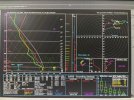
View attachment 38184View attachment 38185
Navigation
Install the app
How to install the app on iOS
Follow along with the video below to see how to install our site as a web app on your home screen.
Note: This feature may not be available in some browsers.
More options
-
Welcome to TalkWeather! We see you lurking around TalkWeather! Take the extra step and join us today to view attachments, see less ads and maybe even join the discussion. CLICK TO JOIN TALKWEATHER
You are using an out of date browser. It may not display this or other websites correctly.
You should upgrade or use an alternative browser.
You should upgrade or use an alternative browser.
Severe WX April 1-2 (overnight) Severe Weather Event
- Thread starter Bulkshear
- Start date
Muwx
Member
Even the most recent run is still a couple degrees too dry. Chickasha is already up to 61, while the 18Z HRRR has them at 59. So the HRRR is still too dry and still chooses violence over a pretty large area.
Does it look clear for North TX, like north DFW metroplex?Literally there's sporadic supercells all the way from south Nebraska to south Oklahoma. Less than ideal. Bad situation could unfold tonight, I'm not missing this. I'm in bed by 8:30-9. I'm staying up for this
You've got options

Muwx
Member
Supercells over Lawton, OKC, Wichita and Salina... insane run.

TH2002
Member
- Messages
- 4,974
- Reaction score
- 11,116
- Location
- California, United States
- Special Affiliations
- SKYWARN® Volunteer
Somewhat off topic, but considering what date it is I really hope people under the gun today are taking this threat 100% seriously.
On April 1, 1946, a massive earthquake caused a tsunami that devastated multiple towns in Hawaii - and before it struck there were reports that some people thought the tsunami warnings were a joke.
159 people died in Hawaii that day.
On April 1, 1946, a massive earthquake caused a tsunami that devastated multiple towns in Hawaii - and before it struck there were reports that some people thought the tsunami warnings were a joke.
159 people died in Hawaii that day.
Kds86z
Member


US_Highway15
Member
So much joy in that smile! He definitely loves what he does.
TornadoFan
Member
Love or hate him, gotta admire the passion he has for this.
A lot of attention (understandably) on OK tonight...
But keep a very close eye on Northern IL tomorrow for a relatively early EF3+ tornado threat. Surface low/triple point will be sitting right under the nose of the 500mb upper jet. Quite a few models develop an isolated supercell or two in this region. Wind profiles paired with solid instability will likely be highly conducive to strong tornadoes. This hodograph may not seem your typical plains or dixie large and looping profile, but this specific shape (subtle curve, very strong storm relative inflow) has a long history of very powerful tornadoes.

This is obviously a fairly conditional risk, and the whole larger warm sector to the SE will be also primed for severe weather tomorrow, but I thought it might be mentioning as it may end up catching some by surprise I feel. Will have to track morning observations carefully to see if this threat remains tomorrow...
But keep a very close eye on Northern IL tomorrow for a relatively early EF3+ tornado threat. Surface low/triple point will be sitting right under the nose of the 500mb upper jet. Quite a few models develop an isolated supercell or two in this region. Wind profiles paired with solid instability will likely be highly conducive to strong tornadoes. This hodograph may not seem your typical plains or dixie large and looping profile, but this specific shape (subtle curve, very strong storm relative inflow) has a long history of very powerful tornadoes.
This is obviously a fairly conditional risk, and the whole larger warm sector to the SE will be also primed for severe weather tomorrow, but I thought it might be mentioning as it may end up catching some by surprise I feel. Will have to track morning observations carefully to see if this threat remains tomorrow...
wx_guy
Member
- Messages
- 1,237
- Reaction score
- 4,443
- Location
- United States
- HAM Callsign
- KO4ZGH
- Special Affiliations
- SKYWARN® Volunteer
- ARRL Member
Looking at recent HRRR trends and comparing it to the mesoanalysis, I think Oklahoma especially is destabilizing quicker than the last few runs of the HRRR shows.
Looks okay on the HRRR, I would still keep a eye out though.Does it look clear for North TX, like north DFW metroplex?


TH2002
Member
- Messages
- 4,974
- Reaction score
- 11,116
- Location
- California, United States
- Special Affiliations
- SKYWARN® Volunteer
tennessee storm chaser
Member
- Messages
- 1,877
- Reaction score
- 4,283
- Location
- jackson tennessee
- Special Affiliations
- SKYWARN® Volunteer
FWIW. Latest hrrr for tomorrow has moved super cells in western half tn bout 50 miles further east more nasvhvilke getting more involved now
And here I thought the RRFS was undergoing rehab for its bath salts addiction (LOL).View attachment 38162
I didn't know the RRFS was in operation again, and now I wish it was still not in operation.

Unfortunately, the pic isn't showing up for me.All eyes are on central Oklahoma (understandably so) but I pulled this sounding from the Wichita area off the 21z GFS. Not really sure what to make of it. Any thoughts?
(Sorry for the photo of a computer screen, I pulled this up on our work computer)
Why is the RRFS so off?And here I thought the RRFS was undergoing rehab for its bath salts addiction (LOL).