• Welcome to TalkWeather!
    We see you lurking around TalkWeather! Take the extra step and join us today to view attachments, see less ads and maybe even join the discussion.
    CLICK TO JOIN TALKWEATHER

2025 Global Tropical Cyclone Season Discussion

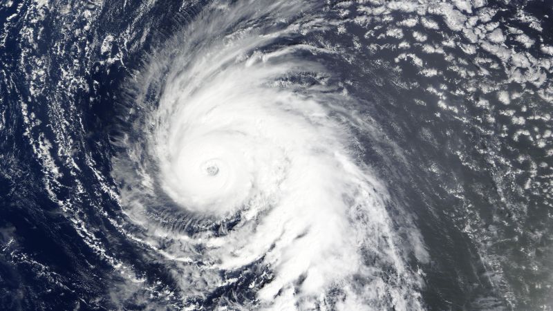
The JTWC has noted Invest 92W:

ABPW10 PGTW 050600
MSGID/GENADMIN/JOINT TYPHOON WRNCEN PEARL HARBOR HI//
SUBJ/SIGNIFICANT TROPICAL WEATHER ADVISORY FOR THE WESTERN AND SOUTH
PACIFIC OCEANS/050600Z-060600ZJUN2025//
RMKS/
1. WESTERN NORTH PACIFIC AREA (180 TO MALAY PENINSULA):
A. TROPICAL CYCLONE SUMMARY: NONE.
B. TROPICAL DISTURBANCE SUMMARY:
(1) THE AREA OF CONVECTION (INVEST 92W) PREVIOUSLY LOCATED NEAR
9.6N 136.5E IS NOW LOCATED NEAR 9.8N 136.4E, APPROXIMATELY 104 NM WEST
OF YAP. ANIMATED MULTISPECTRAL SATELLITE IMAGERY (MSI) AND A 042045Z
SSMIS 91GHZ MICROWAVE IMAGE DEPICT A SLOWLY CONSOLIDATING RAGGED DEEP
CONVECTIVE BANDING OBSCURING THE LOW-LEVEL CIRCULATION CENTER.
ENVIRONMENTAL ANALYSIS REVEALS A MODERATE TO FAVORABLE ENVIRONMENT
WITH LOW VERTICAL WIND SHEAR (VWS) OF 10-15 KNOTS, MODERATE EQUATOR
OUTFLOW, AND WARM SEA SURFACE TEMPERATURES OF 30-31C. DETERMINISTIC
AND ENSEMBLE MODELS ARE IN GOOD AGREEMENT REVEALING GRADUAL
DEVELOPMENT OVER THE NEXT FEW DAYS. THE MODEL GUIDANCE BETWEEN GFS AND
ECMWF INDICATE VARYING TIMELINES OF DEVELOPMENT. HOWEVER, 92W IS
LIKELY TO DEVELOP IN THE NEAR TERM DESPITE A TUTT CELL INDUCING THE
10-15KT VERTICAL WIND SHEAR FROM THE NORTH WHILE THE TUTT ALSO
FAVORABLE ENHANCES OUTFLOW POLEWARD. MAXIMUM SUSTAINED SURFACE WINDS
ARE ESTIMATED AT 13 TO 18 KNOTS. MINIMUM SEA LEVEL PRESSURE IS
ESTIMATED TO BE NEAR 1010 MB. THE POTENTIAL FOR THE DEVELOPMENT OF A

SIGNIFICANT TROPICAL CYCLONE WITHIN THE NEXT 24 HOURS IS LOW.
(2) NO OTHER SUSPECT AREAS.
C. SUBTROPICAL SYSTEM SUMMARY: NONE.
2. SOUTH PACIFIC AREA (WEST COAST OF SOUTH AMERICA TO 135 EAST):
A. TROPICAL CYCLONE SUMMARY: NONE.
B. TROPICAL DISTURBANCE SUMMARY: NONE.
C. SUBTROPICAL SYSTEM SUMMARY: NONE.//
NNNN
 
And the Eastern Pacific AOI is up to 30% in 48 hours/2-days and is still at 80% in 7-days;
IMG_7425.jpeg
 
A study on Atlantic Nino against ENSO:

Our analysis of observational and reanalysis datasets during 1948-2019, together with model experiments, shows that Atlantic Niño strengthens the Atlantic intertropical convergence zone, increasing rainfall over the west African sub-Sahel region and African easterly waves. Additionally, the enhanced atmospheric convection produces low-level westerly wind anomalies over the tropical North Atlantic, which in turn increase low-level relative vorticity and decrease vertical wind shear over the Atlantic TC main development region (MDR). These atmospheric conditions over the MDR are favorable for increasing Atlantic TC activity. Further analysis shows that the tendency for La Niña to enhance Atlantic TC activity is amplified during Atlantic Niña and weakened during Atlantic Niño. Conversely, unfavorable conditions for Atlantic TC activity during El Niño are amplified during Atlantic Niña, but suppressed during Atlantic Niño. This study suggests that Atlantic Niño/Niña may aid to improve the current seasonal prediction skill of Atlantic TC activity.

Fascinating, so could be active year for Atlantic, above average? And what’s MDR mean? @Atlantic
 
Last edited:
Fascinating, so could be active year for Atlantic, above average? And what’s MDR mean? @Atlantic
Main Development Region aka the Tropical Atlantic.

Basically the area between the Cabo Verde Islands and the Western African coast and out to the Lesser Antilles islands framing the eastern Caribbean Sea.

Basically this, the area in the red rectangle;

IMG_7504.jpeg
The Caribbean is also technically a part of the region but the rectangle is the deep tropics region.
 
Fascinating, so could be active year for Atlantic, above average? And what’s MDR mean? @Atlantic
We could see more action in the MDR if the forecasted ATL Nino doesn’t pull a 2021 and shut down the ATL at the start of October.
 
Last edited:
Main Development Region aka the Tropical Atlantic.

Basically the area between the Cabo Verde Islands and the Western African coast and out to the Lesser Antilles islands framing the eastern Caribbean Sea.

Basically this, the area in the red rectangle;

View attachment 43674
The Caribbean is also technically a part of the region but the rectangle is the deep tropics region.

Thank you much @Atlantic!
 
I guess I am wondering could it be worse than 2024 or is 2024 liek one of the top. @Atlantic
It could be similar to 2024. Similar conditions are expected though some things like when or where the storms obviously will be different. I still suspect and think a June MDR storm could happen this year as well if the last few years are any indication.

2021: Hurricane Elsa formed on June 30 as TD Five, became Elsa on July 1. Earliest fifth TD and named storm on record surpassing Edouard from the year prior (2020; Edouard formed on July 5)

2022; PTC Two produced TS-force winds across the western MDR in late June, but failed to close off a circulation until it reached the western Caribbean Sea in the first days of July. It became Tropical Storm Bonnie, which later crossed into the Pacific and became the Eastern Pacific’s first Major Hurricane.

2023; Tropical Storms Bret and Cindy formed on June 19 (Bret) and June 22 (Cindy) first occurrence of more than one storm forming in the MDR in June.

2024; the infamous Hurricane Beryl. Earliest Cat 4 while in the MDR. Formed on June 28 and became the first June MDR hurricane in the satellite era overnight on June 29. Became the first June MDR Major Hurricane on record on June 30. Surpassed the 1933 Triadad Hurricane (Hurricane Two) for easternmost hurricane in the month of June. Beryl later became the earliest Cat 5 on record very late July 1 but early July 2 UTC time.

Crazy @Atlantic. Hope it doesn’t happen again. Got family in Florida.
 
It could be similar to 2024. Similar conditions are expected though some things like when or where the storms obviously will be different. I still suspect and think a June MDR storm could happen this year as well if the last few years are any indication.

2021: Hurricane Elsa formed on June 30 as TD Five, became Elsa on July 1. Earliest fifth TD and named storm on record surpassing Edouard from the year prior (2020; Edouard formed on July 5)

2022; PTC Two produced TS-force winds across the western MDR in late June, but failed to close off a circulation until it reached the western Caribbean Sea in the first days of July. It became Tropical Storm Bonnie, which later crossed into the Pacific and became the Eastern Pacific’s first Major Hurricane.

2023; Tropical Storms Bret and Cindy formed on June 19 (Bret) and June 22 (Cindy) first occurrence of more than one storm forming in the MDR in June.

2024; the infamous Hurricane Beryl. Earliest Cat 4 while in the MDR. Formed on June 28 and became the first June MDR hurricane in the satellite era overnight on June 29. Became the first June MDR Major Hurricane on record on June 30. Surpassed the 1933 Triadad Hurricane (Hurricane Two) for easternmost hurricane in the month of June. Beryl later became the earliest Cat 5 on record very late July 1 but early July 2 UTC time.

Very impressive breakdown!! @Atlantic
 
I'm here!
pat pat
The 2025 season has begun. Nothing to track in the ATL right now but the EPAC is just popping off like a gun, unlike last year (2024) which had several different disturbances Forecasted Convective Amplification Deficiency until Aletta formed on July 4th.
 
The second Eastern Pacific AOI went code orange for the 7-day range in just 2 outlooks, after being noted for the first time in today second most recent outlook.

IMG_7676.jpeg
IMG_7675.jpeg
We could see not one but two tropical cyclones here soon if the eastern disturbance doesn’t get absorbed in the western disturbance before it can develop enough.
 
Both AOIs in the Eastern Pacific are now Invests. The eastern one is 92E and the western one is 91E.

92E is up to 60/70 on formation chances
91E is up to 60/80 on formation chances.

It appears that this mess with two separate systems is part of a monsoon trough breakdown in the region.
IMG_7732.png
 
The Eastern Pacific is partying! Literally compared to last year at this time!
Both AOIs in the Eastern Pacific are now Invests. The eastern one is 92E and the western one is 91E.

92E is up to 60/70 on formation chances
91E is up to 60/80 on formation chances.

It appears that this mess with two separate systems is part of a monsoon trough breakdown in the region.
View attachment 43793
 
Makes me wonder, could this season be very active…
IMG_7774.jpeg
The recipe for very active to hyperactive seasons are this;

  • Cooler subtropics and warmer tropics
  • Low wind shear
  • Cool neutral ENSO or weak La Niña
  • Warm waters
  • Little to no wavebreaking
  • The “horseshoe” of Sea Surface Temperature anomalies being above average
 
The cooler subtropical Atlantic vs warmer tropical Atlantic was pronounced in my second analog year for this year’s hurricane season;
IMG_7775.jpeg

It was very pronounced in 2005, let many (rightfully) to think that (which became infamous) it would be very active.
IMG_7777.jpeg
I think at the time the average was 1971-2000 and the average president (for 2005 at least) was lower.

2017 was using the 1981-2010 average.
 
Back
Top