
Navigation
Install the app
How to install the app on iOS
Follow along with the video below to see how to install our site as a web app on your home screen.
Note: This feature may not be available in some browsers.
More options
-
Welcome to TalkWeather! We see you lurking around TalkWeather! Take the extra step and join us today to view attachments, see less ads and maybe even join the discussion. CLICK TO JOIN TALKWEATHER
You are using an out of date browser. It may not display this or other websites correctly.
You should upgrade or use an alternative browser.
You should upgrade or use an alternative browser.
2025 Atlantic Hurricane Season
- Thread starter Atlantic
- Start date
Kds86z
Member
Kds86z
Member
Kds86z
Member
Lake Martin EF4
Member
That was fast! Guess Gabrielle was looking at the WPac and taking notes!
slenker
Member
Gabrielle is now a category 4. Talk about explosive intensification this year, good lord.
Tropics always manage to wake up on us.

ZCZC MIATWOAT ALL
TTAA00 KNHC DDHHMM
Tropical Weather Outlook
NWS National Hurricane Center Miami FL
800 PM EDT Mon Sep 22 2025
For the North Atlantic...Caribbean Sea and the Gulf of America:
Active Systems:
The National Hurricane Center is issuing advisories on Hurricane
Gabrielle, located over the central subtropical Atlantic.
1. Central Tropical Atlantic:
Shower and thunderstorm activity associated with a tropical wave
located about midway between the Lesser Antilles and the Cabo Verde
Islands show some signs of organization. Environmental conditions
are forecast to become more favorable for development by tomorrow,
and a tropical depression is likely to form on Wednesday or
Thursday while the system moves west-northwestward to
northwestward across the central Atlantic.
* Formation chance through 48 hours...low...30 percent.
* Formation chance through 7 days...high...80 percent.
2. East of the Leeward Islands:
A tropical wave located about 250 miles east of the Leeward Islands
is producing disorganized showers and thunderstorms. Environmental
conditions appear marginally conducive for some development over the
next few days as the wave moves quickly westward to
west-northwestward at 15 to 20 mph. By the latter part of this
week, the system is expected to slow down and turn northwestward,
and a tropical depression could form late this week when the system
is over the southwestern Atlantic Ocean or near the Bahamas.
Regardless of development, gusty winds and heavy rainfall are
expected to affect portions of the Leeward Islands late tonight and
Tuesday and near Puerto Rico late Tuesday and Wednesday.
* Formation chance through 48 hours...low...10 percent.
* Formation chance through 7 days...medium...50 percent.
Forecaster Pasch
Kds86z
Member
Lake Martin EF4
Member
I found this meme on Storm2k and I'm keeping it
Jokingly, Hurricane Gabrielle set new record for most consecutive hours at 50mph winds with no convection at center.
- Thread starter
- #1,031
I found this meme on Storm2k and I'm keeping it
I feel like I saw that meme before it was posted… Deja vu…
Kds86z
Member
KakashiHatake2000
Member
- Thread starter
- #1,034
First Hurricane Warning for the Azores since October 2nd, 2019 with Hurricane Lorenzo
dessertdoom
Member
Kds86z
Member
Hello @dessertdoomwell.
it happened i guess.
(also hi; first post.)
dessertdoom
Member
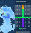
94L doesn't look far behind. No shortage of convection, at least - not sure how much spin it's got.
View attachment 46654
i'm not terribly well-versed in this sort of thing so you'll have to forgive me if i put my foot in my mouth and only manage shove it deeper instead of back out but that's really neat and now i'm curious about the possibility of getting to observe the fujiwhara(sp?) effect.
i don't want to say "excited" because the last time a hurricane hit us was fiona back in 2022 and we're still fishing hunks of PEI out of the ocean but it'd still be neat.
Kds86z
Member
Welcome to the forum @dessertdoom . I don’t about hurricanes much but welcome.i'm not terribly well-versed in this sort of thing so you'll have to forgive me if i put my foot in my mouth and only manage shove it deeper instead of back out but that's really neat and now i'm curious about the possibility of getting to observe the fujiwhara(sp?) effect.
i don't want to say "excited" because the last time a hurricane hit us was fiona back in 2022 and we're still fishing hunks of PEI out of the ocean but it'd still be neat.
- Thread starter
- #1,040
I’m a knowledgeable person in TCs, but if you need to know more technical stuff, @JPWX is the person to ask.i'm not terribly well-versed in this sort of thing so you'll have to forgive me if i put my foot in my mouth and only manage shove it deeper instead of back out but that's really neat and now i'm curious about the possibility of getting to observe the fujiwhara(sp?) effect.
i don't want to say "excited" because the last time a hurricane hit us was fiona back in 2022 and we're still fishing hunks of PEI out of the ocean but it'd still be neat.
I can tell you generally where they track and the average season numbers in the basin, and more if you want.