KakashiHatake2000
Member
80-90 percent of tropical development
Follow along with the video below to see how to install our site as a web app on your home screen.
Note: This feature may not be available in some browsers.
There’s this recently:
View attachment 45851
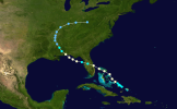
That’s a dip to the south slightly, which famously storms like Ike or more famously Irma have taken at some point in their lifetime.
Ike:
View attachment 45852
Irma:
View attachment 45853
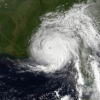
I’m not sure on an Andrew-style approach yet, but we will see.Far from a perfect fit but hurricane Andrew from 1992 heading northwest also gives off vibes.

MFW in 10 days the remnants of Hurricane Erin knock an entire tree into my house lmaofinal destination
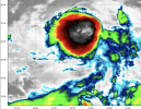
On that note, anyone see the satellite on this thing? It's like for real a tropical storm at this point, has to be...*bets money on it*I don’t want to be that guy, but I think this thing is going to go high end C4 at minimum, regardless of land impacts. It’s just got so much model agreement on a strong hurricane occurring, and with the extremely warm bath waters it’s making a beeline towards, I’m pretty confident that it’s going to be at least a C4 hurricane. If I were a betting man, I’d put some money on it going 160+ mph at some point in its life.

Yeah, the hurricane models are definitely beating the deterministic and AI models currently. This thing is gonna be a hurricane by Tuesday I think.It is sure starting to get that appearance of a TS, along with very frequent bubbling convection too:
View attachment 45877
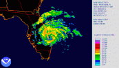
Funny enough, a Category 2 Hurricane Erin struck the east coast of Florida in late July and early August in 1995:MFW in 10 days the remnants of Hurricane Erin knock an entire tree into my house lmao
"You never know when..."
EDIT: Also, hilariously, the name this storm is going to receive was also the name of a character who received one of the most gruesome deaths of the entire series. Who loads that many nails into a nail gun?


It’s still not fully certain yet if this will be a U.S. storm or not, and that concern is on my mind every day now since the disturbance appeared.Yeah, the hurricane models are definitely beating the deterministic and AI models currently. This thing is gonna be a hurricane by Tuesday I think.
Yeah, the hurricane models are definitely beating the deterministic and AI models currently. This thing is gonna be a hurricane by Tuesday I think.
Yeah that's true! The AI models and the deterministic models have a very difficult time dealing with "grey swan" events, for example, rapid intensification. Even the AI models are probably going to disappoint in that regard, due to their structure and design. But the hurricane models might be more accurate in detecting RI. This might be very important not just for the mesoscale development of the storm, but also on its path, as a mature storm vertically aligned is influenced more by the upper level patterns. I think your point about a trough off the northwest coast is a key pattern point .The one thing I will say is a trough off the northwest coast of the U.S. has had a history of U.S. hits. Carol was one example back in the 50s. Something to watch.
