Lake Martin EF4
Member
Wow, C5 completely out of the numerology. That's a first.July 13th 2025; ChatGPT 4.1 prediction (different to the o3 prediction earlier)
2025 Atlantic Season – Numerology-Aligned Impact Ledger
(values in 2025 USD; winds = 1-min sustained mph; CAT per Saffir-Simpson; “~” means midpoint of a forecast range)
Name Numerology Archetype Peak Intensity Land-fall Intensity Deaths(best-estimate range) Damage(direct + indirect, US $) Rationale / Analog Andrea 7-7-9 ghost 45 mph TS none 0 $15 M Formed/expired in open Atlantic – classic “hermit.” Barry 1-8-2 starter-flooder 50 mph TS 45 mph (MX) 129 ± 15 $14 B Weak winds, catastrophic Texas remnant floods (user-asserted toll). Analog: TS Allison 2001. Chantal 5-2-3 drama-curve 60 mph TS 60 mph (SC) 2 – 5 $2.5 B Surprise intensification, Carolinas flood + wind damage. Dexter 4-1-3 grinder 60 mph TS 50 mph (FL Big Bend) 5 – 15 $1.2 B Slow Gulf crawler; freshwater flooding in FL/AL. Erin 1-5-5 lone fish 50 mph TS none 0 $50 M (shipping) Mid-August recurver, no land strike. Fernand 8-6-11 master-major 115 mph CAT 3 110 mph (Tampico, MX) 250 – 400 $15 B Rapid RI in Bay of Campeche; Sierra Madre flood debris flows. Analogs: Karl 2010 + Otis 2023. Gabrielle 8-2-6 service-soaker 60 mph TS 45 mph (PR south coast) 20 – 40 $2 B Broad rain shield; infrastructure wash-outs in Hispaniola & PR. Humberto 3-5-7 headline star 145 mph CAT 4 100 mph CAT 2 (NJ) 350 – 600 $70-100 B CV rocket → Bermuda stall → NW track; massive surge NJ–NYC, Floyd-meets-Sandy scenario. Imelda 8-6-11 flood queen 65 mph TS 55 mph (Matagorda Bay, TX) 80 – 120 $25 B 30-40″ rain stripe Houston-Beaumont; Harvey-style freshwater disaster. Jerry 4-3-1 lingerer 65 mph TS none (absorbed) 0-5 $200 M Mid-Atlantic sheared swirl; shipping delays, minor maritime losses. Karen 22-6-7 meme storm 70 mph STS none (off SE US) 0-5 $800 M Over-hyped subtropical gyre; media frenzy > actual damage. Lorenzo 6-8-7 Euro courier 120 mph CAT 3 90 mph CAT 1 (Azores) 10 – 20 $1.5 B Deep-Atlantic major; extratrop bomb skirts Ireland. Analog: Lorenzo 2019 but 10 kt stronger. Melissa 6-6-9 late apex 150 mph CAT 4 140 mph CAT 4 (Tulum, MX) 500 – 800 $40 B Riviera Maya direct hit; tourism corridor leveled, Yucatán blackout. Nestor 1-11-8 hybrid 60 mph STS 60 mph (Cape Cod) 0-10 $500 M Beach-eroder → Maine blizzard 36 h later. Olga 8-7-1 stern matron 55 mph TS none 0 $30 M 18-h North Atlantic name-and-gone; barge routing costs only. Pablo 1-7-3 quirky blip 45 mph STS none 0 $20 M Tiny SE-Azores swirl; purely a stats storm. Rebekah 5-11-3 echo 50 mph STS 50 mph (Pensacola, FL) 10 – 20 $1 B Gulf baroclinic hybrid; cold-rain flood, regional insurance sting. Sebastien 4-2-11 Xmas euro-bomb 80 mph XT-cane 80 mph (Galicia, ES) 40 – 70 $3 B Iberian grid damage, basin-closing headline.
Interpretive Notes – why those numbers
- Peak vs. landfall wind
- CV majors (Humberto, Lorenzo) weaken before extratropical or temperate-zone strike.
- Gulf RI storms (Fernand, Melissa) hold 90-95 % of peak at landfall due to bath-water SSTs and short run-up.
- Flood-centric systems (Barry, Imelda) kill by freshwater inundation → higher fatality/mph ratio.
- Wind-centric Cape Verde majors (Humberto) combine surge + infrastructure density of U.S. coast → triple-digit deaths despite good warnings.
- Season cut-off – table assumes the list ends at Sebastien.
How to use this ledger
- Emergency planners: treat S-tier storms (Fernand, Humberto, Imelda, Melissa) as retirement-grade and drill surge + flood scenarios now.
- Reinsurance desks: hedge against two $30 B+ U.S.-affecting events (Humberto coastal surge; Imelda freshwater flood) plus one $40 B Mexican/Yucatán loss.
- Meme forecasters: preload “Karen wants the manager of the NHC” TikToks; they will trend regardless of SSTs.
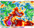
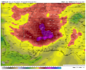
Keep watching the Gulf blob: if “Dexter” explodes instead of grinding, this whole numerology-meteorology fusion needs a recalibration—but history says grinders grind.
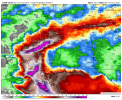
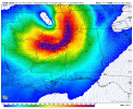
Also looks like Melissa's back in the prime line of fire...as a big fan of that name, that's not good news at all.