JFL at this boyo claiming the seas are much cooler
Total underestimation
Posted Sunday at 07:15 PM
From WxBell/JB:
The 2025 Hurricane Season
February 7, 2025
- The 2025 Hurricane Season should have fewer impacts than 2024.
- 2018 is the closest analog.
- Unlike last year, there are currently no clear landfall signals.
- The high-impact forecast area map will be issued with the April update.
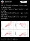
- An El Niño may develop but likely won't be a huge factor if it does.
Forecast according to the Power & Impact Scale
Named Storms: 15-19 ( Saffir Simpson, same)
Category 1 or greater hurricanes: 7-9 ( Saffir Simpson, same)
Category 2.5 (start of Power & Impact major hurricane classification): 3
Saffir-Simpson Hurricane Wind Scale Forecast
Named Storms: 15-19
Total Hurricanes: 7-9
Major Hurricanes: 2-3
ACE Index: 120-150
Impact Forecast and this is what I am most concerned with, the number game above is window dresing
Tropical Storm Conditions: 5-7.
Total Hurricanes: 3-4
Major Hurricanes: 1-2
Commentary
The forecast is based on the overall cooling of SSTs in the Atlantic and forecasted warming in the ENSOareas of the Pacific. Even now, the Main Development Region is much cooler than last year at this time.
I believe the Euro has the right idea on the ENSO region, which is the opposite of last year when the strong El Niño collapsed. This year, the Euro is forecasting a weak La Niña reversing to an El Niño by the hurricane season.