
Navigation
Install the app
How to install the app on iOS
Follow along with the video below to see how to install our site as a web app on your home screen.
Note: This feature may not be available in some browsers.
More options
-
Welcome to TalkWeather! We see you lurking around TalkWeather! Take the extra step and join us today to view attachments, see less ads and maybe even join the discussion. CLICK TO JOIN TALKWEATHER
You are using an out of date browser. It may not display this or other websites correctly.
You should upgrade or use an alternative browser.
You should upgrade or use an alternative browser.

wx_guy
Member
- Messages
- 1,237
- Reaction score
- 4,443
- Location
- United States
- HAM Callsign
- KO4ZGH
- Special Affiliations
- SKYWARN® Volunteer
- ARRL Member
The NHC issued a special Tropical Weather Outlook this morning and mentioned that the red area (93L) will probably be a depression later today. 90/90 chances on itIn addition to Francine, 4 other areas being monitored by NHC.
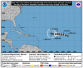
View attachment 29840
TornadoFan
Member
Oh now the Atlantic decides to get going?
- Thread starter
- #344
slenker
Member
We now have TD seven in the Atlantic.
- Messages
- 751
- Reaction score
- 2,465
- Location
- Mississippi State University
- Special Affiliations
- SKYWARN® Volunteer
- Thread starter
- #347
Just a sidenote. I will always remember Tropical Storm Gordon (2018). It was the first tropical system that I went down for and intercepted. I predicted how it would be east side weighted and all that. The only big factor was the location. I told my dad Orange Beach due to it being east side weighted, but I wasn't 100% certain until a dream I had the Friday night the week before Gordon was forecasted to make landfall. Short backstory: my grandpa died a few days after Christmas 2014 from cancer. We were close, but I didn't realize how close until he passed. The dream I had was him sitting in his chair at my grandparent's house and him taking my hand and telling me: "your mom said that you wanted to tell me about your tropical forecast." I woke up the next morning 100% certain that Orange Beach was the right call and it was. I've never forgotten it.
- Moderator
- #348
Invest 95L labeled off the Southeast coast may become a weak tropical depression or storm before moving inland into the Carolinas and bringing heavy rain totals for them into parts of the Mid-Atlantic.
A few days ago, the models showed signs for tropical mischief originating out of the Carribean in 10+ day period. Looks like that potential is still showing now inside the 10 day period with development potentially coming as early as next weekend. If there is development, it could easily be pulled north and threaten the US with an already weakness and approaching trough.
A few days ago, the models showed signs for tropical mischief originating out of the Carribean in 10+ day period. Looks like that potential is still showing now inside the 10 day period with development potentially coming as early as next weekend. If there is development, it could easily be pulled north and threaten the US with an already weakness and approaching trough.

- Thread starter
- #350
NHC will initiate advisories on Potential Tropical Cylone Eight, located offshore of the Southeast U.S. coastline, at 500 PM EDT
wx_guy
Member
- Messages
- 1,237
- Reaction score
- 4,443
- Location
- United States
- HAM Callsign
- KO4ZGH
- Special Affiliations
- SKYWARN® Volunteer
- ARRL Member
Anyone else closely monitoring the EC-AIFS, the new AI-enhanced Euro model? It predicted (and was very insistent) on a central Louisiana landfalling hurricane for many days, before any of the other models really latched onto it. I think this model could come out as the superstar of the season and moving forward.
Well, it's been very persistently wanting to put a storm into the Eastern Gulf for quite a few runs now. Around September 25 or so. I'm gonna watch that closely, as today, the GFS and regular Euro are sniffing that out also...
Well, it's been very persistently wanting to put a storm into the Eastern Gulf for quite a few runs now. Around September 25 or so. I'm gonna watch that closely, as today, the GFS and regular Euro are sniffing that out also...
jiharris0220
Member
I really can’t get over the sustained northern offset of the monsoon trough right now. Tropical waves are even at this point forming in the middle of the Sahara.

The Hadley cell over Africa is still over amplified and therefore will continue to shove the wave train into the Sahara, which is causing record breaking rainfalls there.
As long as the 200mb temperatures over Iberian Peninsula stay’s at such high levels the African Hadley cell is going to stay morphed latitudinally.
And these well above average 200mb temps in the subtropics certainly isn't helping with instability, this plus and now a suppressive phase MJO now in play is why models went from hurricane Gordon to naked swirl Gordon.

This has got to be one of the most least eventful northern hemisphere TC seasons since 2013. Obviously though storms like Beryl and Haiyan could’ve preferably not have occurred.
At least the good news is we now have at least 2 ways a season busting black swan event can happen.
2013, THC shut down leading to low salinity causing poor ocean heat content and anomalously southern based jet stream triggering “spring like” conditions over the Atlantic. So despite 14 NS forming, all but 2 became hurricanes, minimal ones at that due to most being constantly sheared apart allowing for dry air intrusions.
2024, record breaking anomalously warm 200mb TPs over the Atlantic and Iberian Peninsula causing stability issues and more importantly the Hadley cell over Africa to become hyper stretched latitudinally. Leading to the over extension of the monsoon trough northward, causing tropical waves to form deep into the Sahara. This is responsible for historic amounts of rain and flooding in the middle of the desert. Obviously it has rained heavily in the Sahara in the recent past, but not like this. (https://www.livescience.com/planet-...nnected-to-a-calmer-atlantic-hurricane-season)

Extremely low SSP in the Sahara led by extension +NAO regime led to cooling of the Canary current which further led to instability issues and is also responsible for the dragging of the ITCZ (and possibly the monsoon trough) too far north.
The Hadley cell over Africa is still over amplified and therefore will continue to shove the wave train into the Sahara, which is causing record breaking rainfalls there.
As long as the 200mb temperatures over Iberian Peninsula stay’s at such high levels the African Hadley cell is going to stay morphed latitudinally.
And these well above average 200mb temps in the subtropics certainly isn't helping with instability, this plus and now a suppressive phase MJO now in play is why models went from hurricane Gordon to naked swirl Gordon.
This has got to be one of the most least eventful northern hemisphere TC seasons since 2013. Obviously though storms like Beryl and Haiyan could’ve preferably not have occurred.
At least the good news is we now have at least 2 ways a season busting black swan event can happen.
2013, THC shut down leading to low salinity causing poor ocean heat content and anomalously southern based jet stream triggering “spring like” conditions over the Atlantic. So despite 14 NS forming, all but 2 became hurricanes, minimal ones at that due to most being constantly sheared apart allowing for dry air intrusions.
2024, record breaking anomalously warm 200mb TPs over the Atlantic and Iberian Peninsula causing stability issues and more importantly the Hadley cell over Africa to become hyper stretched latitudinally. Leading to the over extension of the monsoon trough northward, causing tropical waves to form deep into the Sahara. This is responsible for historic amounts of rain and flooding in the middle of the desert. Obviously it has rained heavily in the Sahara in the recent past, but not like this. (https://www.livescience.com/planet-...nnected-to-a-calmer-atlantic-hurricane-season)
Extremely low SSP in the Sahara led by extension +NAO regime led to cooling of the Canary current which further led to instability issues and is also responsible for the dragging of the ITCZ (and possibly the monsoon trough) too far north.
Last edited:
warneagle
Member
relatable, honestly


- Moderator
- #357


- Moderator
- #358

- Thread starter
- #359
Disrupted filming of Season 100 of The Curse Of Oak Island.