Navigation
Install the app
How to install the app on iOS
Follow along with the video below to see how to install our site as a web app on your home screen.
Note: This feature may not be available in some browsers.
More options
-
Welcome to TalkWeather! We see you lurking around TalkWeather! Take the extra step and join us today to view attachments, see less ads and maybe even join the discussion. CLICK TO JOIN TALKWEATHER
You are using an out of date browser. It may not display this or other websites correctly.
You should upgrade or use an alternative browser.
You should upgrade or use an alternative browser.
Hurricane Melissa
- Thread starter Jacob Aden
- Start date
lake.effect
Member
I've got to disagree with you there, at least in terms of the permanent population. Most of Kingston, all of Saint Catherine, etc. - all up off the water enough that surge isn't a huge risk, at least according to the model I posted above.
Yes.
Right, but the areas higher in elevation are far enough inland that, even if they were not elevated, would be protected from the surge due to being far away enough from the sea.
A really bad surge can go inland 1/2 mile, maybe 1 mile tops under ideal conditions (Katrina, for example. The entire MS coast is flat as a pancake).
Kingston's downtown area and immediate surroundings are not elevated. There is plenty of very populated terrain near the coast (within 1 mile) that is essentially flat.
joshoctober16
Member
N0mz
Member
Migth be a buzzsaw tomorrow morning
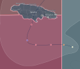
NHC forecasts landfall at strong C4 strength. On the plus side, elevations in the center of Jamaica might shield the north to some degree. On the downside, large cities like Port Moore (150,000+) and Kingston (>650,000) are topographically very shallow, and the shape of Kingston Harbor and surrounding environs may amplify surge. Kingston's larger airport is located in an extremely vulnerable location. Some residential areas in the northern areas of the capital may be protected from surge, but not from wind. All-in-all, an extremely dangerous situation for Jamaica's south.


joshoctober16
Member
joshoctober16
Member
wx_guy
Member
- Messages
- 1,208
- Reaction score
- 4,341
- Location
- United States
- HAM Callsign
- KO4ZGH
- Special Affiliations
- SKYWARN® Volunteer
- ARRL Member
I think we're about a couple days from witnessing something truly horrific.
TornadoFan
Member
I sadly very much agree. The landslides, inland flooding, surge where it is flat... all just sideshows (albeit horrible ones!) for the fact that cat 4+ winds for that long of a duration will just shred a place.I think we're about a couple days from witnessing something truly horrific.
WeathermanLeprechaun
Member
I don't do doom and gloom, and never will.
But when you've got a high end hurricanes with biblical levels of rain approaching the most populated city in Jamaica, there is a decent chance a absolutely dire situation will unfold. Do not downplay this, this doesn't have to be a C5 to cause the most horrific impacts. Katrina wasn't a C5 within landfall, it was C3 and still caused a a absolutely unforgettable level of destruction across NOLA. People are at sincere danger if they do not evacuate.
But when you've got a high end hurricanes with biblical levels of rain approaching the most populated city in Jamaica, there is a decent chance a absolutely dire situation will unfold. Do not downplay this, this doesn't have to be a C5 to cause the most horrific impacts. Katrina wasn't a C5 within landfall, it was C3 and still caused a a absolutely unforgettable level of destruction across NOLA. People are at sincere danger if they do not evacuate.
WeathermanLeprechaun
Member
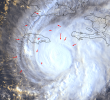
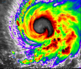
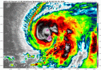
Here we go.Stacked, shear basically gone - I expect we'll have a clear eye within hours and a major by morning.
View attachment 47787
Ozonelayer
Member
First time tracking a hurricane. Looking at everything, this is extremely dire. I cannot put into words how terrible this is shaping up to be. This is looking terrible, and it hasn't even made landfall.
Keep a very close eye on how large it gets as well; there is a chance the entire southern coast gets bombarded by significant storm surge of some kind.
Keep a very close eye on how large it gets as well; there is a chance the entire southern coast gets bombarded by significant storm surge of some kind.
lake.effect
Member
I think we could see a major before midnight...
lake.effect
Member
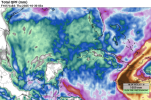
btw, the official forecast is now calling for 40" in isolated places on Jamaica's east coast with widespread 30-40 inches in that area.
Kingston averages 32 inches of rain per year.
Kingston averages 32 inches of rain per year.
Welcome to a hobby that will consume your Septembers and Octobers. My first time tracking one was in the 90s, but I think I started tracking every one after Charley hit Punta Gorda in 04.First time tracking a hurricane.
45 minutes later...Migth be a buzzsaw tomorrow morning
Cyclonic Paracosm
Member
I- I have really crappy gut feeling rn its moving extremely slowly in the hot tub of hot tubs, I just have that feeling this won't weaken at landfall, man I hope they took actions for safety

