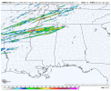
The 10z is incredibly nasty for extreme north Mississippi.
The instability has come down a decent bit from past runs
The instability has come down a decent bit from past runs
Follow along with the video below to see how to install our site as a web app on your home screen.
Note: This feature may not be available in some browsers.
Do you have any idea as to why?The 10z is incredibly nasty for extreme north Mississippi.
The instability has come down a decent bit from past runs
Ahhh, I turned 17 on the 16th of march. Been in love with weather since I was 8 from watching Storm Chasers, Twister, and Into The Storm, literally hundreds of times.8th.
EDIT: just to clarify, I'm 15, I was just not in school from 2017-2023 and ended up going to middle school rather than high school so I'd adjust easier.
Across all models or just HRRR?The 10z is incredibly nasty for extreme north Mississippi.
The instability has come down a decent bit from past runs

The discussion also mentions “long-track, strong to potentially violent tornadoes”Over 18 million people in the hatched TOR risk area
Well this changed a lot
At least a few long-track, strong to potentially violent tornadoes are probable, particularly over portions of the Mid-Mississippi Valley to the Mid-South.The discussion also mentions “long-track, strong to potentially violent tornadoes”
This also sets up spatially for a high risk corridor. These type of days are why they issue high risks. They’ve made it clear in conversations and social media posts. We’ll see if the trigger is pulled at 1630z or a special update is released via MCD.At least a few long-track, strong to potentially violent tornadoes are probable, particularly over portions of the Mid-Mississippi Valley to the Mid-South.
Not possible... Probable... This is probably the strongest worded outlook I've ever seen that isn't a high risk.
Sent from my SM-S901U using Tapatalk
No clue lolDo you have any idea as to why?
At least a few long-track, strong to potentially violent tornadoes are probable, particularly over portions of the Mid-Mississippi Valley to the Mid-South.
Not possible... Probable... This is probably the strongest worded outlook I've ever seen that isn't a high risk.
Sent from my SM-S901U using Tapatalk
I don't think it was necessarily a uptrend in potential, more so a higher confidence in the outcome trend lolThis was a pretty profound uptrend from night to morning.
Is this on all the mesoscale models? Strong UAH does not look to be as widespread as one yesterday’s CAMs.No clue lol
Yeah, this was my thought, delineate the broad MDT area and then issue more localized high area once it's clearer where things are gonna be focused. Seems like a reasonable approach.This also sets up spatially for a high risk corridor. These type of days are why they issue high risks. They’ve made it clear in conversations and social media posts. We’ll see if the trigger is pulled at 1630z or a special update is released via MCD.
Again, confidence must be high that an area will receive convection (supercells), and that convection will have sufficient time within a parameter space that is supportive of tornadic supercells producing significant/violent tornadoes. This has that potential.