CheeselandSkies
Member
HRRR has a bow echo going through southern SC this evening affecting many of the same areas trying to clean up from yesterday's tornadoes.
Follow along with the video below to see how to install our site as a web app on your home screen.
Note: This feature may not be available in some browsers.

Is it possible it managed to not hit any houses or other structures when at peak intensity? Maybe while it was over open fields or a forest.The Allendale tornado had a satellite tornado at one point.
View attachment 13258
I will say that it was an absolutely massive looking tornado with violent looking radar returns (and satellite tornadoes are rarer outside of intense tornadoes), so the relative lack of damage reports is a surprise. Hopefully this tornado was more bark than bite, or maybe there's something we haven't seen yet? I know it did destroy a few mobile homes and unroof some others but that's about it.
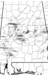
Per the 10 AM AFD from BMX, it would seem so.We must be under a cap up here. Just took the dog for a walk, and even with a breeze, with the sun and humidity, it's hot! I know the conditions aren't the same, but the way it feels outside and the way the sky looks, remind me of April 8, 1998 and Nov. 10, 2002. Nothing scientific, just memory. But SPC shows the worst south of us, so I don't know.
The KBMX 12z sounding observed drier air aloft with a cap
above 750mb. As we get more daytime heating we should be able to
overcome that cap with time, then the question becomes the amount
of upper level dynamics available to support organized severe
storm structures.
We must be under a cap up here. Just took the dog for a walk, and even with a breeze, with the sun and humidity, it's hot! I know the conditions aren't the same, but the way it feels outside and the way the sky looks, remind me of April 8, 1998 and Nov. 10, 2002. Nothing scientific, just memory. But SPC shows the worst south of us, so I don't know.

Looks solid EF4 to me