• Welcome to TalkWeather!
    We see you lurking around TalkWeather! Take the extra step and join us today to view attachments, see less ads and maybe even join the discussion.
    CLICK TO JOIN TALKWEATHER

Severe WX 12/15/21 Midwest Severe/Wind Threat

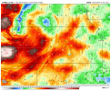
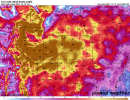
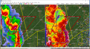
Can't tell if BIG TDS just popped up just south of Giltner, NE or if that's some sort of radar noise.

Edit: I think Giltner just got smacked, blue blob coincident with the couplet on the 2011 UTC scan.

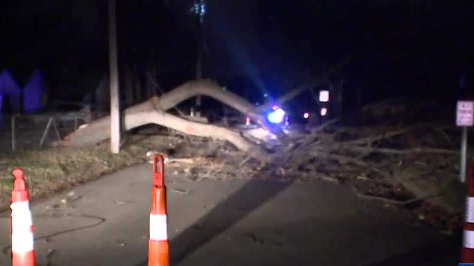
Tornado reported on the ground with that storm.
 
Current wind speeds and gusts.
 

Attachments

  • rtma-anl-kansas-wnd10m_stream_mph-9597500.png
    rtma-anl-kansas-wnd10m_stream_mph-9597500.png
    180.5 KB · Views: 0
  • sfcgust_mph.us_c.png
    sfcgust_mph.us_c.png
    602.2 KB · Views: 0
After the initial few, haven't seen any clear TDS' on radar for a while. Of course, storms of interest are currently about equidistant between Hastings and Omaha NEXRAD, with the 0.5 tilt hitting above 4,000'. That says these tornadoes, if they are on the ground, aren't lofting debris particularly high. At least, not like what was seen last Friday night (to be expected). However, I wonder if that might also be due in part to the environmental straight-line winds being so strong that they are scattering the debris before it can rise in a relatively concentrated area that would be picked up by the radar.

Edit: Very possible TDS over Columbus, NE on the 2105 UTC scan, but NWS didn't pick up on it (no TORR).

Edit 2: Apparently a TORR did go out, but my GR Level 3 didn't display it in real time. The pink polygon shows up now when I play the loop back.
 

Attachments

  • OAX_2105_CC.png
    OAX_2105_CC.png
    1.1 MB · Views: 0
Last edited:
The SVR warning texts in KS and NE have "THESE ARE DESTRUCTIVE STORMS" attached to them, which I don't think I've seen before. I don't know if that's technically a PDS warning, but I assume it's part of the whole impact-based warning thing.
 
The SVR warning texts in KS and NE have "THESE ARE DESTRUCTIVE STORMS" attached to them, which I don't think I've seen before. I don't know if that's technically a PDS warning, but I assume it's part of the whole impact-based warning thing.

I think that's the new method to make certain high-end/high expected impact severe thunderstorm warnings trigger WEAs on phones.
 
I think that's the new method to make certain high-end/high expected impact severe thunderstorm warnings trigger WEAs on phones.
Oh okay, I assumed it had some sort of technical purpose. Hopefully it gets people to take it seriously rather than just seeing the alerts as an annoyance.
 
Back
Top