
Weatherphreak
Member
Storms popping SW of Little Rock could be the start of the party.
Follow along with the video below to see how to install our site as a web app on your home screen.
Note: This feature may not be available in some browsers.
74 degrees, humidity 90.7, and dewpoint 71.1 here in Smithville, MS.
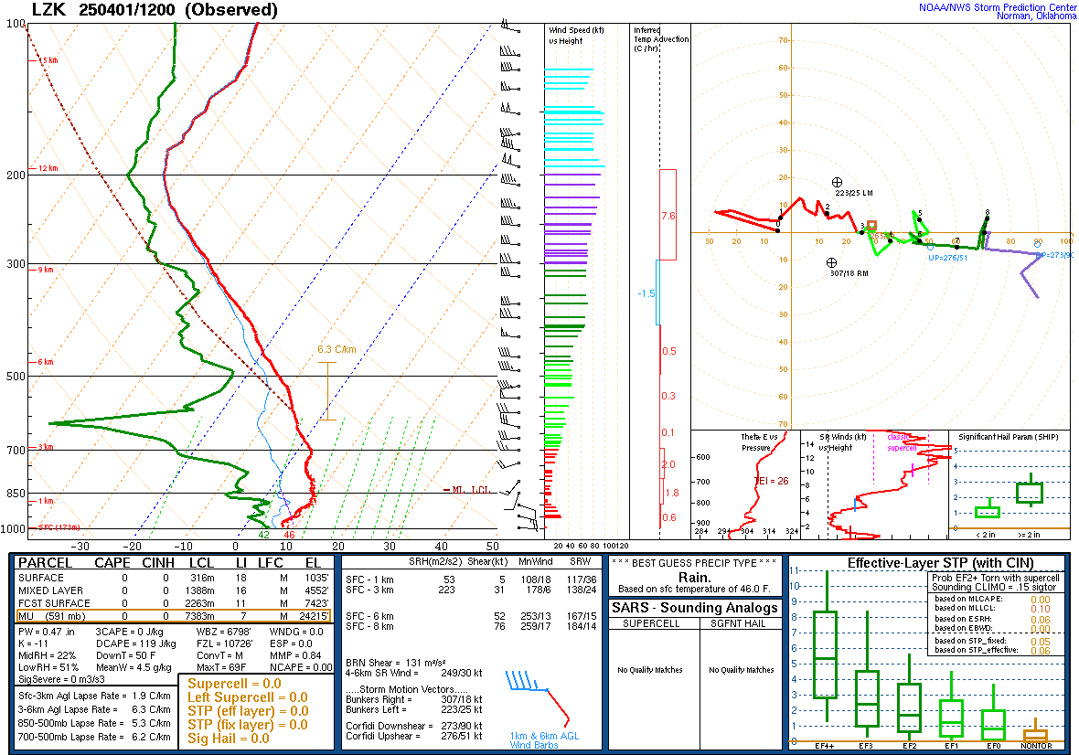
Special sounding from Little Rock is, uh, concerning. Still capped for the moment but when that cap erodes...whew.
The low level shear isn't quite what you would want to see for violent tornadoes,Ok, is this what you'd call a loaded gun sounding? Obviously being the amateur that I am, I really don't have a clue what I'm reading here.
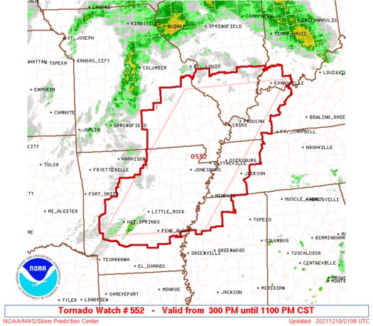
I was wondering the same thing.A little surprised they didn't go with PDS wording, since that watch covers the moderate/15% hatched.

I have seen PDS tornado watches with 70/50 tornado probabilities.Don't PDS watches usually have 90/80 probs?
PDS watches have >= 80% probabilities for EF2+ TORs.Don't PDS watches usually have 90/80 probs?
I have seen them lower than that before. Ex...80/60 or 70/50.PDS watches have >= 80% probabilities for EF2+ TORs.
That’s what I was told. Perhaps it just depends on the forecaster then??? I have seen them lower than that before. Ex...80/60 or 70/50.

It also may have to do with the wind and hail probabilities being not as high as well.That’s what I was told. Perhaps it just depends on the forecaster then???
It also may have to do with the wind and hail probabilities being not as high as well.
i would think so too but I did wonder about the hail and wind probs.I doubt it. When a PDS watch is issued for tornadoes, it's based strictly on the expected tornado threat.