MD 0392 CONCERNING SEVERE POTENTIAL...WATCH POSSIBLE FOR PORTIONS OF THE TX BIG COUNTRY AND VICINITY

Mesoscale Discussion 0392
NWS Storm Prediction Center Norman OK
0231 PM CDT Sat Apr 01 2017
Areas affected...Portions of the TX Big Country and vicinity
Concerning...Severe potential...Watch possible
Valid 011931Z - 012200Z
Probability of Watch Issuance...60 percent
SUMMARY...Portions of the Big Country of TX and vicinity are being
monitored for increasing severe-thunderstorm potential this
afternoon, and a watch may become necessary for parts of the area.
DISCUSSION...Surface observations and recent visible satellite
imagery indicate a quasi-stationary boundary extending from west of
Wichita Falls to a triple-point low near Howard County to the TX
Trans-Pecos region. A dryline arches from the low to the Stockton
Plateau, with a plume of 8-9-C/km lapse rates in the lowest 3 km AGL
extending from the TX Trans-Pecos region to the proximity of the
dryline circulation. Meanwhile, within the warm/moist sector,
poleward moisture transport continues, with dewpoints in the
lower/middle 60s as far north as a wavy, diffuse warm front / marine
boundary analyzed from southern parts of the Low Rolling Plains to
northern parts of central TX. Steep midlevel lapse rates surmounting
the warm/moist boundary layer are supporting MLCAPE around
1000-2500 J/kg near and south of the warm front, which should slowly
build northward during the next several hours.
Relatively more widespread insolation across the western fringes of
the warm/moist sector has given way to increasingly agitated
boundary-layer cumulus fields within about 60-90 miles east of the
dryline. Related erosion of capping, further bolstered by modest
midlevel ascent accompanying a meridionally oriented midlevel speed
maximum glancing the area, should contribute to surface-based
convective development over western sections of the MCD area in the
20-21Z time frame. Thunderstorms will spread generally eastward and
northeastward into the evening hours.
The presence of 35-50 kt of effective shear will support organized
convective structures, including initial supercells/supercell
clusters, capable of large hail and damaging winds. Except for a
small area just south-southeast of the triple point, shear vectors
are oriented generally parallel to initiating boundaries. As a
result, there should be a tendency for convection to locally grow
upscale, mitigating the tornado risk. Nevertheless, pre-existing
vertical vorticity overlapping more robust low-level CAPE near the
triple point could support a tornado or two with the more robust
discrete cells, initially. However, the tornado risk should be
limited by the eventual transition to more linear modes, along with
weak low-level shear.
Farther to the east across north TX, the development of sustained,
surface-based convection is uncertain owing to the lack of stronger
deep ascent. The peripheral influence of the midlevel speed maximum
could offer some potential for thunderstorm development, though this
activity may remain rooted above a stable layer to the north of the
warm front. However, relatively longer/more curved low-level
hodographs with eastward extent across the region, and similarly
favorable deep shear, will offer conditional potential for supercell
storms/clusters to develop. Large hail and damaging winds could
accompany this activity, along with some tornado potential,
especially later in the afternoon and into the evening. This
potential will largely depend upon whether storms form in the more
modest warm-advection plume to the east, and whether storms ingest
surface-based effective inflow -- both factors are presently
associated with marked uncertainty.
..Cohen/Hart.. 04/01/2017
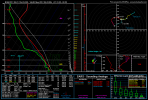
...Please see www.spc.noaa.gov for graphic product...
ATTN...WFO...FWD...OUN...SJT...LUB...MAF...
LAT...LON 31320006 31380070 31680103 31990126 32430124 32880057
33320003 33669945 33909871 33819806 33419761 32679764
31999822 31579908 31320006
Read more
For additional SPC information click here