
southmdwatcher
Member
COD SPC page now has the Day 2 outlook and it is much different, large Enhanced risk with 10% hatched TOR from north central VA down to eastern GA, includes much of NC
Follow along with the video below to see how to install our site as a web app on your home screen.
Note: This feature may not be available in some browsers.
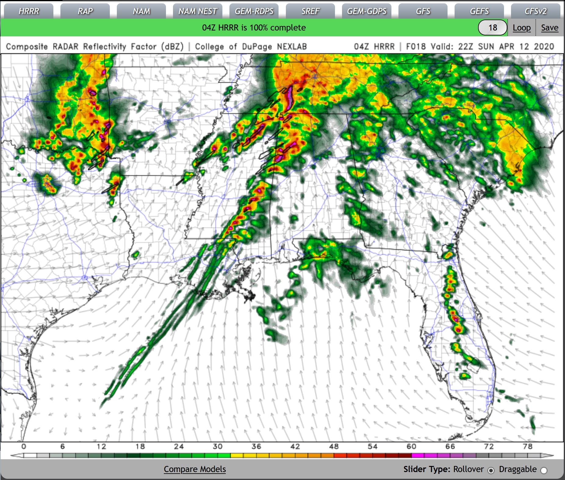
and they just keep coming..just west of Birmingham.
View attachment 2770

Great hodo and incredible turning with height there.I don't trust the CAMs right now to perfectly capture the evolution of the overnight and morning convection, but for what it's worth, 04z HRRR sounding near Jasper ahead of that line of supercells. Shear profiles are just... really don't have any adjectives left

Latest HRRR run is absolutely apocalyptic.

The orientation of the cold front is going to be very important in determining the mode along the front. If the orientation is more N and less parallel to the storm motions, that cold front is going to produce some of the most dangerous supercells of the entire day, which would make the risk much higher in AR and TN. The latest SPC update expands the enhanced all the way into Kentucky likely to account for this possibility. In the case it's more parallel, it's more likely to be a QLCS with possible embedded supercells.The HRRR has trended towards a much more open warm sector over the past several runs, and the MCS developing over east OK has a significant E/ENE component of motion.
The path for a morning high risk is paved.
Yeah, and, after reading it, the SPC didn't even mention potentially pulling the High Risk trigger. Everything is there, so I would at least expect some sort of upgrade wording.
I'm not going to say wh
Yeah, and, after reading it, the SPC didn't even mention potentially pulling the High Risk trigger. Everything is there, so I would at least expect some sort of upgrade wording.
If the HRRR trends continue, and the convection out west trends more NE than E, I still think we easily see a high risk by 13z or 1630z; most of this started trending back upwards again too close to the issuance of the first D1 outlook to make an upgrade wise just yet I think. Dunno why the wording isn't in there, I think an upgrade is pretty likely. Really getting nervous chills here