• Welcome to TalkWeather!
    We see you lurking around TalkWeather! Take the extra step and join us today to view attachments, see less ads and maybe even join the discussion.
    CLICK TO JOIN TALKWEATHER

Severe Weather 2026

Interesting signal on the Day 6 CIPS. Random little 45% nipple. Definitely don't see those probabilities this far out very often.

This is a day that has also looked quite interesting on the GEFS ensemble SCP for a dozen or so runs now. The latest run has more certainty on location, but less certainty about the actual existence of a severe weather threat, with multiple members now showing nothing at all. Similar nipple presentation on the mean SCP.

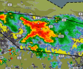
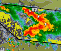
View attachment 54728View attachment 54729View attachment 54730
will illinois ever catch a break?? I'm honestly so done with severe weather, lets just move on to winter and snow. I've been excited about winter for a while now lol
 
will illinois ever catch a break?? I'm honestly so done with severe weather, lets just move on to winter and snow. I've been excited about winter for a while now lol
Day Moving GIF
 
Quick writeup regarding svr setups this week

IMO, I'm a bit skeptical of a 5% tmrw but there's some reasons.

79/71 according to models in N Indiana with robust low level stretching, subtle dry air aloft and cool enough mid levels to allow for vertical instability. Low level shear will not be particularly strong tomorrow. Supercells fire and may maintain discrete nature for around a hour or two. Isolated tornado or two possible. As storms congeal, profiles will turn very dry, with a damaging wind risk increasing, tornado chances low but not ruled out by this point.

Thursday

Expecting potential for a messier regime of supercells utilising low level stretching + stronger LL shear in NE PA/SE NY. Profiles feature dry air aloft and mid level cooling along with a area of increased 850mb response. Isolated tornado threat a decent likelihood here.

Mesoscale days probable after this mini-sequence. Ensemble guidance isn't strong.

SPC is noting a feature in the D7-8 period however and has had some stronger wording on it but confidence is still too low for any potential outlook.
 
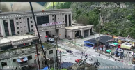
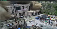
Absolutely incredible images coming out of Nepal from the flooding last night and today:

Screenshot 2026-08-26 12.05.21 PM.pngScreenshot 2026-08-26 12.05.57 PM.pngScreenshot 2026-08-26 12.06.05 PM.png
This is by a long shot the most violent flooding/mudslide I've ever seen.
 
Not sure where else to put this but worth noting that DAT received an (in my opinion terrible-looking) update/UI overhaul a few hours ago.
 
Step Back Before And After GIF

The latest DAT update:
They literally just made it harder to use by making everything clunkier and less visually appealing. Very odd change unless they are purposefully trying to bring back 2018.
 
That's
They literally just made it harder to use by making everything clunkier and less visually appealing. Very odd change unless they are purposefully trying to bring back 2018.
90% of companies nowadays. Nothing particularly fun about a interface, it's just how clean and boring you can make it. I miss the old times when interfaces actually had a feel and look about them
 
Back
Top