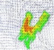
About 20 people with home damage currently in pinson. From trees falling on homes or the roofs getting torn up some. National weather service says microburst
Last edited:
Follow along with the video below to see how to install our site as a web app on your home screen.
Note: This feature may not be available in some browsers.
Yep, I remember 3/19/18 very well. Pretty scary setup, and quite unusual for the area. Actually, though it obviously wasn't the same kind of synoptic situation, the convective evolution of the cells yesterday reminded me of it just a bit.Spann is a pro at criticism. I'm very sure every time they need to interrupt regular coverage there's been mean tweets about him. That seems to be the case for many. Spann is a great guy and mistakes happen.
I'm going away to Paris from next Friday to Sunday, so i hope I don't miss anything particularly noteworthy next week. Hopefully not but very active pattern on the way.
Regarding 2018, that was a year where most setups verified their floor and some verified or overperformed. I think a lot forget how impressive the parameter space for 3/19/18 was. It was a intense ceiling, supporting large hail and intense tornadoes. We did verify a EF3, but a significant outbreak was expected and that isn't what happened. Mostly a hail dominant day with some tornadoes snuck inbetween. The only notable plains/rockies event of the year was 6/28/18 and 5/1/18 in Tescott. Then you had the surprise July event in Iowa that warranted a TORE. 12/1/18.
Not to be any harsh but I don't really care for tornado season forecasting. Things can change very rapidly in the ocean over these months and that's what caused last year to be a more active year than was expected for many. There's no genuine way to know how active a season will be until it happens.

 jhomenuk.substack.com
Cameron Nixon's research finds that storms can produce pretty large hail with no CAPE, all it takes is just a bare bit of instability, steep lapse rates aloft, and the storm will do the job. I've seen 4 inch hail in a general tstm risk in Texas once
I remember this since I woke up at 10am that morning (in Ireland) and watched those surprise big hailers take place. Hail forecasting is complicated. Was a interesting event to watchWe had a surprise elevated-supercell significant hail event in our local area just last April. Storms rolled in during the early hours of April 18th, still during the valid period of the April 17 evening outlook which had us in marginal risk, followed by barely upgrading a small portion of southeastern Wisconsin to a slight risk starting at 12Z (7 AM CDT) the 18th.
12Z-12Z 4/17 reports
12Z-12Z 4/18 reports
I was at work and we were on the air with our morning local newscast (4:30-7AM) when the EAS box in the production control room pinged for the first severe thunderstorm warning while we were in a commercial break. I was able to get in our meteorologist's ear and let him know so he could mention it first thing after the break ended; while I took the Village of Cassville, WI webcam which showed near-constant lightning over the Mississippi River as the storms crossed into southern Wisconsin. Starting shortly thereafter we were wall-to-wall for nearly the next three hours.
Well they definitely need it
It's pretty trashy and selfish...some of the messages I've seen since his social media post. Every day, my trust in people close and far from me dwindles, even in the weather enterprise, and I have no feeling towards them. Anyways, away with the OT flood. March looks to be very active, to those who careFrom a message posted on FB by Spann four hours ago. He admitted he was wrong. Moving on...
"It likely that a small tornado moved through parts of Pinson. Trussville damage was either a weak tornado or a gustnado. NWS Birmingham will do their survey this morning. This wasn't on the bingo card for yesterday."
"I will post the survey results when they come in. There has been some pretty nasty criticism of me on social media since yesterday, which mostly was deserved. But remember, you. can't hurt my feelings; I have no feelings left to hurt after 47 years of this."

Yeah March 2023 and 2025 were nuts. I forget 2024.To be fair, March has been a lot more active than April the last few years. I agree that first part of April should be colder than normal especially around Easter (with final frost/freeze threat for southern states as well around that time). However, after that, we should flip the pattern back mid/late April going into May. We'll see though. I have my suspicions that April will be more active than it's been the last few years.