tempostorm
Member
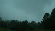
That radar version has the line looking alot worse than the other ones ive been looking at, yikesYikes, not looking forward to this.
View attachment 43843
Follow along with the video below to see how to install our site as a web app on your home screen.
Note: This feature may not be available in some browsers.
That radar version has the line looking alot worse than the other ones ive been looking at, yikesYikes, not looking forward to this.
View attachment 43843
Lots of preliminary storm reports around that area already. Storm reports are piling up in Georgia as well.Well, we’ve been without power here in West Cullman for roughly 3 hours now. Hopefully with the sunshine, crews can restore pretty quickly.

yeah, the local co-op is having to call in contract crews because of all the broken pole across the county.Lots of preliminary storm reports around that area already. Storm reports are piling up in Georgia as well.
View attachment 43845


Wondering if the east Mississippi portion will be a tornado watch instead of severe watch.This may become a little interesting with that kind of hodograph and low-level shear output. This is Tupelo, MS. evening
View attachment 43850

Makes you wonder a little? But with the low level helicity/shear being modest, like some other events of late, there may be enough spacing to include all of North MS. I'll guess we'll see.Wondering if the east Mississippi portion will be a tornado watch instead of severe watch.


Well, we’ve been without power here in West Cullman for roughly 3 hours now. Hopefully with the sunshine, crews can restore pretty quickly.