KevinH
Member
Well so much for the 30th being the last day of this event… good grief
Follow along with the video below to see how to install our site as a web app on your home screen.
Note: This feature may not be available in some browsers.
Well so much for the 30th being the last day of this event… good grief
@Clancy you need a promotion or a tag of some sort around here… seriously!Continue to be impressed by how wide of a warm sector will be in place on Sunday, basically all across the MSV, TN Valley and into the Gulf Coast. Helicity has been improving run-to-run on the GFS in terms of areal coverage, and while it's not the strongest I've ever seen, it'd be more than enough, especially in stronger pockets that keep popping up run-to-run in parts of the Midwest and Upper MSV. Additionally, a really broad area to watch, so a lot of places likely under the gun on Sunday. On Monday, it looks like more of a damaging wind event, and maybe a hail threat as well across the Southeast. However, latest 12Z GFS shows a significant improvement in helicity (sounding from NE AL; slightly contaminated but represents the environment pretty well). If that were to pan out, could definitely foresee a jump in the tornado threat on Monday. Still a lot of questions, and I would wager that the SPC is well-served to keep the threats at 15% both days until the bigger model discrepancies start to sort out, but could be a severe threat for a very wide swath of the US, and could include a supercellular threat both days. Likely will be a time to stay tuned and buckle up if you're anywhere across the eastern half of the country.
View attachment 37300View attachment 37301View attachment 37302View attachment 37303View attachment 37304View attachment 37305View attachment 37306View attachment 37307View attachment 37308View attachment 37309
On that note, now's a great time to grab a NOAA Weather Radio. Just bought one for a friend who doesn't have one, and with an active April on tap, would be a very thoughtful gift for the folks in your life that could benefit from one. The newest version of Midland's flagship radio, the WR120B, has some new features now, including 3 language options for its interface and customizable alert volumes.
Nahhh, I'm just a nerd who likes to look at clouds. The mets are the real smarties, and they deserve all the credit and praise they get and so much more.@Clancy you need a promotion or a tag of some sort around here… seriously!
@MichelleH @WesL @JayF SOS lol
Yep. One thing I try to tell people is that what happened during the last storm (or any previous storm for that matter), has NOTHING to do with a current storm.With the uptrends on the models today, I'd expect to see a 30% area (roughly encompassing N MS, NW AL, W TN, etc.) soon. Definitely looks like a troubling trend, if it continues. In the pattern we're in, I'm somewhat concerned the public will get weary and desensitized to the severe weather threats, especially if "last time" nothing happened at their particular place.
Rare to see my neck of the woods(Eastern KY) in the 65-70 contour. Not really shocking given the vast aerial expanse of the warm Sector.
Small world haha. Harlan born and raised, since moved to Central KY.What part, I grew up around Harlan and Floyd counties, long since moved to Louisville.
Proud to say that I will be attending University of Louisville starting next year!What part, I grew up around Harlan and Floyd counties, long since moved to Louisville.
@UncleJuJu98….. Sir!!! When you tell us about stuff like this, could you post graphics? Some of us are visual learners here LOL!12z euro holds serve, dangerous look on the last three euro runs.
Absolutely not!@UncleJuJu98….. Sir!!! When you tell us about stuff like this, could you post graphics? Some of us are visual learners here LOL!

Don’t mention itMuch appreciated my man. It’s been quite a rough ride. Wanting to swim in college while pursuing your career in meteorology hasn’t been easy, but i’m thankfully almost done and i’ll be able to pursue my swimming and meteorology dreams!
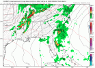
We’ll probably see that until the day of. Pre-event showers/convection is always so hard to parse out in the absence of a very stout EML. Even with that, you may get a random MCS (see 4/27/11). The models really didn’t start honing in on the rain shield for 3/15 until very late the night before. The HRRR bounced back and forth between a completely pristine warm sector with just a few showers up north to a self propagating MCS over Alabama in one run.18z GFS back to the 00z-like run for the Northern part of the risk area. Much less convection during the day. I'm sure we are gonna see the back-and-forth on that over the next few days. If the showers stay away during the day, it would definitely be a pretty widespread event all the way up to around Southern Indiana/Illinois.
30 percent t coming by day 3 part of that , no doubt if models keep trendView attachment 37327
Still astounded with how large this 15% area is!
I'm thinking by tomorrow morning on that, but yeah, no doubt it's coming30 percent t coming by day 3 part of that , no doubt if models keep trend
