Parysa
Member
I drove through the Dallas, GA area this morning and saw the EF-1 tornado damage there. Along the highway, I saw trees uprooted, a couple snapped, some commercial sign damage, and a roof partially taken off a house.
Follow along with the video below to see how to install our site as a web app on your home screen.
Note: This feature may not be available in some browsers.
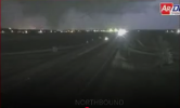
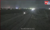
Well, good to know I made the right decision by taking shelter. If it hadn't wrapped up on itself and jogged north a few scans after the one I captured below, it could've been very bad news.I drove through the Dallas, GA area this morning and saw the EF-1 tornado damage there. Along the highway, I saw trees uprooted, a couple snapped, some commercial sign damage, and a roof partially taken off a house.


Here's FFC's PIS for the tornado. Winds estimated at 110 MPH, making it a high-end EF-1.Well, good to know I made the right decision by taking shelter. If it hadn't wrapped up on itself and jogged north a few scans after the one I captured below, it could've been very bad news.
View attachment 36602
NOUS42 KFFC 170050
PNSFFC
GAZ001>009-011>016-019>025-027-030>039-041>062-066>076-078>086-
089>098-102>113-171300-
Public Information Statement
National Weather Service Peachtree City GA
850 PM EDT Sun Mar 16 2025
...NWS Damage Survey for 03/15/2025 Tornado Event...
..Paulding County Georgia Tornado...
Rating: EF1
Estimated Peak Wind: 110 mph
Path Length /statute/: 11.64 miles
Path Width /maximum/: 200 yards
Fatalities: 0
Injuries: 0
Start Date: 03/15/2025
Start Time: 11:41 PM EDT
Start Location: 3 N New Georgia / Paulding County / GA
Start Lat/Lon: 33.8582 / -84.8734
End Date: 03/15/2025
End Time: 11:53 PM EDT
End Location: 1 S Cross Roads / Paulding County / GA
End Lat/Lon: 33.9922 / -84.7564
Survey Summary:
An EF1 tornado with maximum winds of 105 to 110 mph touched down
in central Paulding County on March 15, 2025 at 11:41 PM EST. The
tornado spun up within a strong line of thunderstorms moving
rapidly towards the northeast. The tornado initially touched down
to the southwest of Sudie, GA near Pace Creek Lake, where
multiple large pine trees were downed and an outbuilding was
destroyed. The tornado then tracked northeast where it produced
the initial EF1 rated damage near the intersection of Scoggins
Rd. and Cole Lake Rd. This included numerous large pine trees
downed and power line damage. 2 large pine trees fell on two
homes in the Paces Lake neighborhood. From there the tornado
continued on a northeast track through a mostly forested area
before intersecting Villa Rica HWY near Old Villa Rica Rd. The
tornado paralleled Villa Rica HWY for around 1.5 miles until it
reached the intersection with HWY 278. Damage was most intense
during this phase of the tornado with peak winds estimated in the
105 to 110 range. This included damage to a gas station, numerous
uprooted and topped trees, downed power lines and damage to the
roof of a Kroger grocery store near the intersection of HWY
278 and Villa Rica HWY. After crossing Merchants Dr. the tornado
weakened into the EF0 range as if tracked northeast near Ray
Mountain and into New Hope, GA. Additional EF1 damage was found
just north of New Hope near the intersection of Mount Tabor
Church Rd. and Parkway Ct. Here multiple large trees were
uprooted, a shed was destroyed and several homes were damaged by
falling trees. The tornado then continued towards the northeast
where it caused minor tree and shingle damage in the Reserve
neighborhood. It lifted near the intersection of White Spruce Ln.
and Wood Point Way around 11:53 PM EST. The total number of
structures damaged by the tornado was estimated at 15 by Paulding
Co. EMA.
&&
EF Scale: The Enhanced Fujita Scale classifies tornadoes into the
following categories:
EF0.....65 to 85 mph
EF1.....86 to 110 mph
EF2.....111 to 135 mph
EF3.....136 to 165 mph
EF4.....166 to 200 mph
EF5.....>200 mph
NOTE:
The information in this statement is preliminary and subject to
change pending final review of the event and publication in
NWS Storm Data.
$$
I'm sure you already know, but my New Richmond survey post was satire lol.“engineers found it had been pummeled by debris from other structures”
I’m sorry for the language and ranty off topic comment I’m about to use here, but this is by far one of the most retarded mental gymnastics I’ve seen.
What do they mean? So I guess for a tornado to even have a chance of having a ef4 rating it needs to hit a structure in the middle of nowhere? Any tornado that goes through a high density area is simply capped at ef3 using this logic.
These doofuses are telling us that the complete decimation of that town was caused by mid level cat4 wind gust?
I thought the Jarrel and Joplin survey were IQ debilitating but wow, no wonder Fujita threw this survey to the trash, because that’s exactly what it is.
100%. It’s an outbreak that we will look back on for sure. Those cells early on in Mississippi were absolutely ferocious.I'm just very thankful that yesterday's outbreak didn't meet it's full potential

Bakersfield With some extreme damag
Bakersfield With some extreme damage
t
Bakersfield With some extreme damage
Back on topic, some of the damage in Oil Trough (closer to where the tornado initially touched down) looks potentially high-end. Can't tell how much of this is legit grass scouring though.
Incidentally, Oil Trough was hit by an F4 in 1968.
More damage from an unspecified location somewhere along the path:
Also haven't seen much from east of Tuckerman, where the tornado had a secondary peak on velocity and CC, but idk if any structures got hit on that part of the path.
There could be more tornadoes rated EF4 in other states affected by the outbreak.Wow at the two EF4 ratings in Arkansas. I can almost guarantee we would never have seen that while Robinson was employed at LZK. It’s amazing how one person retiring can change a WFO from being notorious for ridiculously conservative surveys, to becoming perfectly fair now that more reasonable minds are in charge. It really highlights the points I’ve made about the variability of EF scale application depending on the WFO and the people working there.
Same thing happened at NWS Peachtree City. They barely rated Ringgold EF4 back in 2011, but following staff changes there, they became almost too overzealous with higher ratings for a bit there (Newnan, and especially Bonaire). I wonder what the current FFC survey team would rate Ringgold if it happened today…
I guess LZK can now be added to JAN and others for doing good solid ratings.Wow at the two EF4 ratings in Arkansas, including a high-end one! I can almost guarantee we would never have seen that while Robinson was employed at LZK. It’s amazing how one person retiring can change a WFO from being notorious for ridiculously conservative surveys, to becoming perfectly fair now that more reasonable minds are in charge. It really highlights the points I’ve made about the variability of EF scale application depending on the WFO and the people working there. I’m adding them to my list of WFOs I can trust with surveys.
Same thing happened at NWS Peachtree City. They barely rated Ringgold EF4 back in 2011, but following staff changes there, they became almost too overzealous with higher ratings for a bit there (Newnan, and especially Bonaire). I wonder what the current FFC survey team would rate Ringgold if it happened today…
Better yet, imagine if Vilonia 2014 happened with LZKs current staff!
Glad you got through safely!Here's FFC's PIS for the tornado. Winds estimated at 110 MPH, making it a high-end EF-1.
Many thanks! Yep, extremely stressful when family or friends are in the path. Glad your folks are well.Glad you got through safely!
The Sipsey one went very close to my dad, and would have been on track for my mom and sisters had it stayed on the ground. I was on the phone with him and watching it on the television. Incredibly nerve-wracking.