NwAla
Member
Talk weather was about 4 down on my play store.
Sent from my SAMSUNG-SM-G890A using TalkWeather mobile app
Sent from my SAMSUNG-SM-G890A using TalkWeather mobile app
Follow along with the video below to see how to install our site as a web app on your home screen.
Note: This feature may not be available in some browsers.
Ok, thank you!Talk weather was about 4 down on my play store.
Sent from my SAMSUNG-SM-G890A using TalkWeather mobile app
")

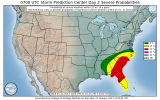
Interesting looking convective outlook for Saturday (valid starting st 6am CST)
I don't understand the "gap"...can they really be that specific? I am fine with it, if it is correct...just seems like an unnecessary gamble to me.If the nam and gfs are correct with the latest runs those two enhanced risks shouldnt have a gap
I completely agree.I don't understand the "gap"...can they really be that specific? I am fine with it, if it is correct...just seems like an unnecessary gamble to me.
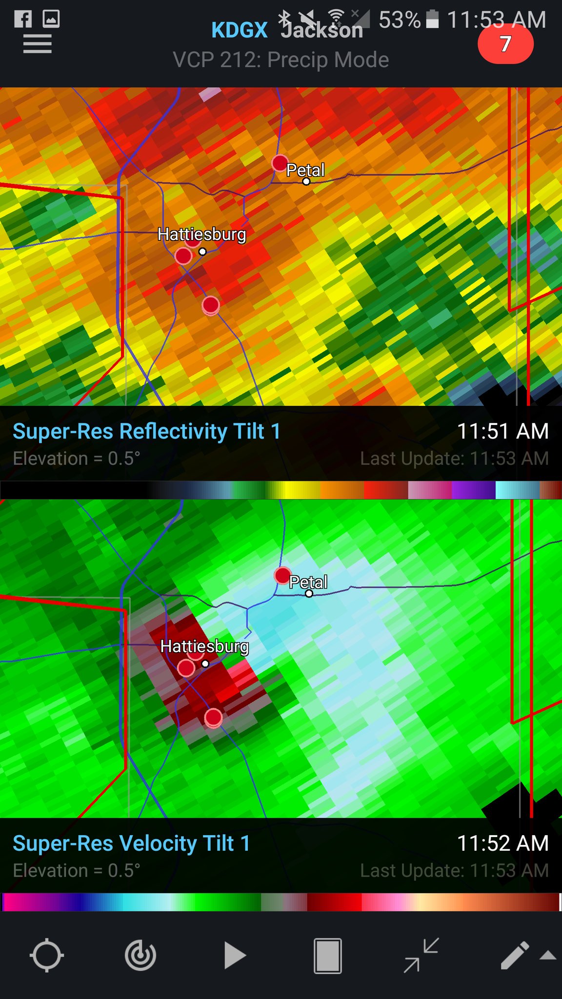
...A TORNADO WARNING REMAINS IN EFFECT UNTIL 515 AM CST FOR
SOUTHWESTERN CHOCTAW...NORTHWESTERN WASHINGTON AND SOUTHERN WAYNE
COUNTIES...
At 429 AM CST, a large and extremely dangerous tornado was located 7
miles west of Clara, or 13 miles southwest of Waynesboro, moving
northeast at 50 mph.
Above where you type your post, you'll see all of the different font, link, etc. options. You'll see a little smiley face, right beside it is a little picture icon. That's where you go to paste the image addresss.BMX n has an enhanced risk across part of NW Alabama tonight, north and west of Bham. I would post a pic but haven't figure out where to uplink yet.

 Latest BMX severe update
View attachment 49 Latest BMX severe update