• Welcome to TalkWeather!
    We see you lurking around TalkWeather! Take the extra step and join us today to view attachments, see less ads and maybe even join the discussion.
    CLICK TO JOIN TALKWEATHER

Winter 2018-2019

skelly

Member
Messages
521
Reaction score
114
Location
Birmingham
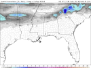
Anyone have a lead on when last cold shots happen I’m not looking for deep freeze just curious as the last couple of freeze/frost events.
 

warneagle

Member
Messages
3,729
Reaction score
3,208
Location
Arlington, VA
Special Affiliations
  1. SKYWARN® Volunteer
Annoying self reply but the NAM brings the snow band through between 7 and 10 AM so commuting tomorrow will be miserable. Then sleet and freezing rain continuing all afternoon. GFS brings the snow through later and gets the wintry stuff out of here by 0z at least. HRRR is closer to the NAM timing but keeps the snow around longer. This is a pick your poison type thing I think. Hopefully the government closes tomorrow since there’s already a winter storm warning.
 
  • Like
Reactions: KoD

warneagle

Member
Messages
3,729
Reaction score
3,208
Location
Arlington, VA
Special Affiliations
  1. SKYWARN® Volunteer
I haven’t been out to measure but just guesstimating that we have about 2.5-3” already and more coming down. Starting to get icy on some of the roads. Glad the government offices closed today but my wife still had to work.
 

skelly

Member
Messages
521
Reaction score
114
Location
Birmingham
I haven’t been out to measure but just guesstimating that we have about 2.5-3” already and more coming down. Starting to get icy on some of the roads. Glad the government offices closed today but my wife still had to work.

Have fun on the winter side this severe rainy foggy floods side wreaks.
 

skelly

Member
Messages
521
Reaction score
114
Location
Birmingham
We’re into warm temps severe weather flooding trees blooming so this concerns me outlook is for above average rain next two weeks or more temps may be moderating to more seasonal with some frost light freezes thrown in I’m not thinking we’re past the chances of snow or ice just keep it in the back of you’re head...
 

Mike S

Administrator
Staff member
Administrator
Moderator
PerryW Project Supporter
Messages
1,991
Reaction score
1,115
Location
Meridianville, Al
Special Affiliations
  1. SKYWARN® Volunteer
Mt. Washington is showing off tonight, setting an all-time February wind record of 171 mph.


The observatory is also live streaming its observations


MattW

Member
Messages
307
Reaction score
206
Location
Decatur, GA
HAM Callsign
KG4GUF
Special Affiliations
  1. SKYWARN® Volunteer
GFS showing a possible wintry event across the SE Monday-Wednesdayish.
 

Attachments

  • GFSSE_prec_snow_189.png
    GFSSE_prec_snow_189.png
    87.5 KB · Views: 0

Kory

Member
Messages
4,928
Reaction score
2,119
Location
Tuscaloosa, Alabama
We’ve seen a lot of systems trend NW with time. We’ll see how this one goes...European is another bout of heavy rainfall for Alabama.
 

Weatherphreak

Member
Messages
351
Reaction score
336
Location
Huntsville
GFS was showing that same system dumping 4 inches of snow in South Mississippi yesterday so I’m not holding my breath. It will be a chilly start to March though for sure.
 

skelly

Member
Messages
521
Reaction score
114
Location
Birmingham
So confidence is low in the forecast for Saturday-Monday which model can handle it this far out. I know some are probably showing winter mischief at least for north alabama for now I know no one is going to give it any credence and I don’t blame them wait and see definitely colder next week I’m sure.
 

warneagle

Member
Messages
3,729
Reaction score
3,208
Location
Arlington, VA
Special Affiliations
  1. SKYWARN® Volunteer
Another 1-2" tonight probably, because apparently mother nature has decided that I deserve to suffer.
 

JayF

Technical Administrator
Staff member
Administrator
Moderator
Sustaining Member
Technical Admin
Messages
1,624
Reaction score
878
Location
Hartselle, al
HAM Callsign
KB4JCS
I am going to Unpin this thread. I hope we can safely say that we will not need this any further.
 
Logo 468x120
Back
Top