Tanner
Member
Western Kentucky cells getting stronger too, I think we're starting to get into the heat of this.
Follow along with the video below to see how to install our site as a web app on your home screen.
Note: This feature may not be available in some browsers.
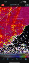
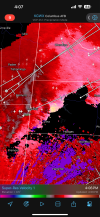
Looks like clear air from what I can see, but it does have rotation.


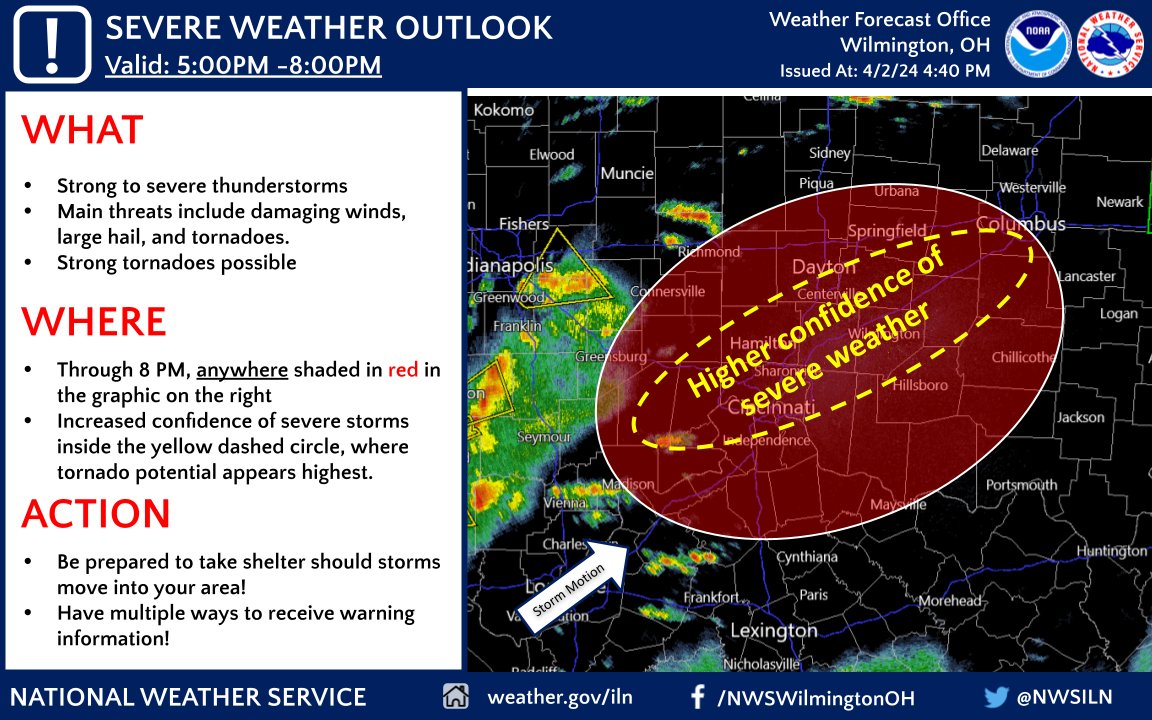
It looked like that was starting to happen around Evansville and then it all kinda re-congealed. Those more discrete storms down in SW KY still need watching.Will be interesting to see if the stronger shear and hodos in the OWS break that line into discrete cells around Louisville
Definitely keeping a close eye on it... luckily does look quite outflow dominant but that could change quickly in the right environment. One positive would be if the outflow manages to cut off some of the developing discretes across KY.Will be interesting to see if the stronger shear and hodos in the OWS break that line into discrete cells around Louisville
could actually be good for the cincy metro if it stays more congealed in a line. Will have to see thoughDefinitely keeping a close eye on it... luckily does look quite outflow dominant but that could change quickly in the right environment. One positive would be if the outflow manages to cut off some of the developing discretes across KY.