- Admin
- #241

Follow along with the video below to see how to install our site as a web app on your home screen.
Note: This feature may not be available in some browsers.
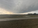
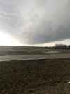
That was fun. In the car heading towards Owen Cross RdsKeeping an eye out with you.
NoIs that a debris ball in Calhoun city?
Sent from my iPhone using TalkWeather
that's probably hail and is on the north side of the rain free baseIs that a debris ball in Calhoun city?
Sent from my iPhone using TalkWeather

Cell south of Kilmichael, MS looks to be developing a weak debris signature