- Thread starter
- #141

Follow along with the video below to see how to install our site as a web app on your home screen.
Note: This feature may not be available in some browsers.

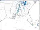
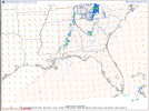
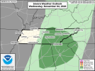
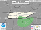
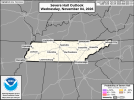
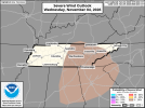
As a storm chaser and severe wx enthusiasts. This far fall weather has been a big ole snooze festWell, thus far, today has gone just about how I figured it would. Too much cloud cover issues and overall there was too much going against a bigger threat. Still though line hasn't yet reached Monroe County so we'll see if any surprises come about. The northern half of the line isn't even producing lightning. Was hoping to put GoPro out, but not now.
Yeah. And that might continue to be the theme going forward for the most partAs a storm chaser and severe wx enthusiasts. This far fall weather has been a big ole snooze fest


BULLETIN - EAS ACTIVATION REQUESTED
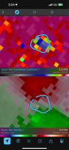
Tornado Warning
National Weather Service Birmingham AL
325 PM CST Wed Nov 4 2026
The National Weather Service in Birmingham has issued a
* Tornado Warning for...
East central Bibb County in central Alabama...
* Until 400 PM CST.
* At 325 PM CST, a severe thunderstorm capable of producing a tornado
was located near Ashby, or 10 miles east of Centreville, moving
northeast at 10 mph.
HAZARD...Tornado.
SOURCE...Radar indicated rotation.
IMPACT...Flying debris will be dangerous to those caught without
shelter. Mobile homes will be damaged or destroyed.
Damage to roofs, windows, and vehicles will occur. Tree
damage is likely.
* Locations impacted include...
Brierfield Ironworks Park and Ashby.
PRECAUTIONARY/PREPAREDNESS ACTIONS...
TAKE COVER NOW! Move to a basement or an interior room on the lowest
floor of a sturdy building. Avoid windows. If you are outdoors, in a
mobile home, or in a vehicle, move to the closest substantial shelter
and protect yourself from flying debris.
&&
LAT...LON 3306 8691 3306 8690 3305 8690 3305 8688
3293 8688 3292 8696 3297 8699
TIME...MOT...LOC 2125Z 238DEG 9KT 3296 8695
TORNADO...RADAR INDICATED
MAX HAIL SIZE...<.75 IN
$$
25/Owen
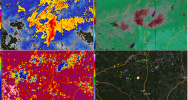
Storms are seizing on seasonably strong instability (2,000+ j/kg) and just enough helicity making it down to the ground to help some storms' tornadogenesis. Best kinematics are still out ahead of the convective focal points, but if they can overlap, most likely over parts of NW GA this afternoon, could result in localized heightened tornado risk.