• Welcome to TalkWeather!
    We see you lurking around TalkWeather! Take the extra step and join us today to view attachments, see less ads and maybe even join the discussion.
    CLICK TO JOIN TALKWEATHER

Severe WX Severe Weather Threat June 19-25

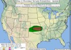
That dry slot and warm nose aloft at 500mb always seems to be a common feature in these setups. Sometimes they don't work and other times they do. Will have to see.

(from yearly thread)

14Z HRRR now introduces a nice southeastward-moving supercell with stout UH from Iowa into Green Counties, WI. Might turn out a bit like the "Independence Day Mothership" of 2022 (the chase where I pulled in behind Vince Waelti and Brandon Copic's Radar Omega/Ryan Hall Y'all-wrapped vehicles).

070422_02_2048.jpg

070422_06_2048.jpg
 
Day 2: possible tornado upgrade to come

WITH STORM MOTIONS LIKELY TO BE ALONG-BOUNDARY. THERE REMAINS STRONG SIGNAL THAT A 40-50 KT SOUTHWESTERLY LOW-LEVEL JET WILL INCREASE INTO THE EVENING ACROSS OKLAHOMA INTO SOUTHERN KANSAS. THIS IN COMBINATION WITH FAVORABLE ALONG BOUNDARY STORM MOTIONS WILL SUPPORT
POTENTIAL FOR TORNADOES, A FEW OF WHICH COULD BE STRONG. THE MAIN
UNCERTAINTY REMAINS IN THE EXACT PLACEMENT OF THE BOUNDARY RELATIVE TO THE MORE FAVORABLE CORRIDOR OF INSTABILITY/LOW-LEVEL JET AXIS. THE 5% TORNADO AREA WAS SHIFTED SOUTHWARD WITH THIS UPDATE TO ACCOUNT FOR RECENT TRENDS. IT IS POSSIBLE THAT IF MORE CONFIDENCE IN THE PLACEMENT OF THESE FEATURES OCCURS, HIGHER PROBABILITIES MAY BE NEEDED. FOR NOW, CONFIDENCE REMAINS MODERATE IN SUPERCELLS
DEVELOPING WITH POTENTIAL FOR LARGE TO VERY LARGE HAIL AND DAMAGING WIND.
 

Attachments

  • IMG_0373.jpeg
    IMG_0373.jpeg
    176.4 KB · Views: 2
Back
Top