atrainguy
Member
The north woods of Wisconsin have entered the picture.
Follow along with the video below to see how to install our site as a web app on your home screen.
Note: This feature may not be available in some browsers.
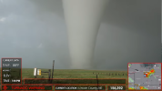
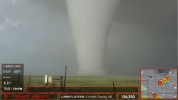
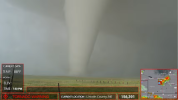
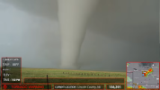
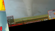
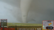
Thank goodness this tornado was over open field, had this thing hit a town the damage would’ve been scary. Nonetheless, I agree this is the tornado of the decade so far. Once people post more video of this, we’ll have that much more awe over this tornado.

So what was main contributor?View attachment 44132
The photogenic Nebraska was a hybrid tornado (red arrow area)
here are some of the parameters of that area
0-1 km BWD: 8 kts
EBWD: 35 kts
0-6 km BWD: 30 kts
ESP: 4.012
BRN: 396.3
SRH3: 121
3CAPE: 118
MLCAPE: 5574
MLCINH: -11


when the parameters match up with everything in typical hybrid tornado on a boundarySo what was main contributor?

My lifelong dream is to plank in front of a tornado. Planking is still a thing right?