• Welcome to TalkWeather!
    We see you lurking around TalkWeather! Take the extra step and join us today to view attachments, see less ads and maybe even join the discussion.
    CLICK TO JOIN TALKWEATHER

Severe Weather Threat June 15-23

The Nam definitely isn't the best model to pull soundings from, and it'll be more interesting to see the RAP soundings once that gets in range, but these are straight up alarming from Kansas on Tuesday. Not cherry picked either, just the first ones i pulled. Check out that SRH

IMG_2440.png
IMG_2441.png

I'll post analogs from my collection of soundings when I get home later today.
 
Ok now there's some cause for concern. RAP soundings are equally alarming as the NAMs and the RAP is normally MUCH more conservative than the NAM. This helicity is bananas. These soundings are from North, Central, and Southern Kansas. Definitely some classic violent tornado Skew Ts and Hodographs.

1750032741012.png1750032829506.png
1750033081531.png
 
Here are those analogs I promised.

05/30/2004 A cyclic supercell that produced 16 tornadoes, DOW recorded 180 mph winds on one of them
1750094770251.png

06/07/2007 Wisconsin long-tracked EF3 and 5" hail
1750094971766.png

05/25/2008 Parkersburg Iowa EF5
1750095131355.png

06/07/2008 Tornado Family in Illinois (up to EF2 strength)
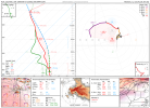
1750095206473.png

05/02/2010 EF4 tornado that occurred simultaneously with 3 other tornadoes including another EF4. This cell went on to produce 20 tornadoes. (effective sheer was way higher than is expected for tomorrow but skew t, hodograph, and vorticity looks very similar)
1750095451594.png

06/17/2010 North Dakota photogenic EF4 that was part of a large-scale tornado outbreak
1750095616908.png

Same outbreak but a particularly cyclic, stationary supercell with reports of over 12 tornadoes (up to EF2) occuring in rapid succession, many simultaneously.
1750095933817.png

04/15/2012 Oklahoma cyclic supercell that produced over 20 tornadoes up to EF3 in strength.
1750096379742.png

05/19/2013 Oklahoma EF4 tornado
1750096514958.png

06/12/2017 The first of several Wyoming tornadoes from a particularly photogenic cyclic mothership supercell
1750096937720.png

continued...
 
05/28/2019 Kansas Long-lived, heavily rain-wrapped EF4 tornado
1750097216166.png

06/09/2019 Kansas Particularly photogenic supercell that produced an anticyclonic tornado amongst others
1750097352602.png

04/20/2023 Kansas supercell that produced 9 tornadoes
1750098182833.png

I compiled these analogs based on Skew Ts and Hodograph similarity. If Effective Sheer was too high, if they occurred in the winter months, or if the vorticity profile was too dissimilar I eliminated them. One common theme I've noticed is highly-cyclical, long lived tornado producing supercells, and relatively unimpressive low pressure systems fueling them. In conclusion, I believe if any isolated supercells start producing tornadoes tomorrow they'll produce a lot in quick succession, and I expect there to be multiple, highly photogenic mothership supercells. I also believe even if these storms form into a QLCS quickly it'll still be prolific and produce several tornadoes.
 
Back
Top