
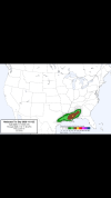
This storm once again reminding me of how much we need a radar east of Meridian, Mississippi.Tight couplet south of waynesboro.
Navigation
Install the app
How to install the app on iOS
Follow along with the video below to see how to install our site as a web app on your home screen.
Note: This feature may not be available in some browsers.
More options
-
Welcome to TalkWeather! We see you lurking around TalkWeather! Take the extra step and join us today to view attachments, see less ads and maybe even join the discussion. CLICK TO JOIN TALKWEATHER
You are using an out of date browser. It may not display this or other websites correctly.
You should upgrade or use an alternative browser.
You should upgrade or use an alternative browser.
Severe Weather Threat January 8-10, 2026
- Thread starter CheeselandSkies
- Start date
- Thread starter
- #302
CheeselandSkies
Member
This storm once again reminding me of how much we need a radar east of Meridian, Mississippi.
Especially since Jackson only updates once every 5-7 minutes (at least on GR Level 3) and has a lot of weird ground clutter artifacts. Not helped by the mayor of Brandon being an idiot and installing a water tower that partially blocks it to the southwest (the most likely direction for tornadic storms to come from).
Thinking that the radars in Mobile, Hammond (previously Slidell), and Greenwood Springs could adequately cover the Jackson area (or indeed, the vast majority of Mississippi) with the low-level scans needed to accurately evaluate a storm's tornado (and other severe weather) potential shows a facepalm-inducing level of ignorance over what radar actually does and how it is used.
...I guess this is how you end up with people theorizing NEXRAD sites are weather modification devices.
Last edited:
Kds86z
Member
Ladies and gents…
Cyclonic Paracosm
Member

Nice lil sup with decent rot to the North and East of Baton Rouge, has had this rot for a hit minute now
Kds86z
Member
Maybe a 5% tor prob coming?12Z CAM suite uptrended the threat for Saturday afternoon across eastern Alabama and western Georgia. 3 of 4 show at least a narrow tongue of instability making it all the way up into northwest Georgia and riding along I-20 in Alabama in the morning-to-afternoon hours on Saturday, ahead of a frontal convective line. Some predict some prefrontal semi-discrete convection. CAPE of 500-1,500 j/kg will be overlapping with decently-curved hodographs, making tornadoes a possibility. Soundings attached from near Ashland, AL and Dallas, GA, respectively. Soundings show ample instability, substantial 3CAPE values and modest but sufficient kinematics. Fascinatingly, HRRR is the most bearish of the CAMs, with muted instability across all but the Gulf Coast. While I don't believe the threat is particularly high, I think it still is very much worth watching, especially if these forecast trends continue.
View attachment 49817View attachment 49818View attachment 49819View attachment 49820View attachment 49821View attachment 49822View attachment 49823View attachment 49824
Newest D2 upgrades to Slight Risk over parts of AL/GA. A localized damaging wind and tornado risk is driving the change, and the latter is still rather conditional.

Day 2 Convective Outlook
NWS Storm Prediction Center Norman OK
1128 AM CST Fri Jan 09 2026
Valid 101200Z - 111200Z
...THERE IS A SLIGHT RISK OF SEVERE THUNDERSTORMS ACROSS PARTS OF
THE SOUTHEAST...
...SUMMARY...
A few severe thunderstorms are forecast on Saturday across the
central Gulf Coast and Southeast.
...Central Gulf Coast into the Southeast...
Along and south of an outflow-reinforced cold front extending across
central AL into southern MS, scattered thunderstorms will be ongoing
across the central Gulf Coast into the Southeast at the start of the
period. These storms will generally be focused along a 30-40-kt
southwesterly low-level jet and ahead of a northeastward-moving
frontal wave.
Despite modest buoyancy, ample boundary-layer moisture (middle/upper
60s dewpoints) and around 50 kt of effective shear will continue to
promote organized storm clusters, to include the potential for a
couple supercells. Damaging winds will be a concern, though enlarged
clockwise-curved low-level hodographs (upwards of 200-250 m2/s2
effective SRH) within the moist axis will yield some risk for a
couple tornadoes as well. The tornado risk will be largely dependent
on the degree of convective overturning in the warm sector. The
window of greatest severe risk appears to be from 12Z-18Z -- before
low-level flow veers ahead of the approaching front and departing
frontal wave. A SLGT risk was added for this corridor of heightened
severe potential.
Thunderstorms will generally spread northeastward across GA into the
Carolinas in tandem with the northeastward-advancing low-level jet
and frontal wave, where they will eventually outpace the
surface-based warm sector during the afternoon.
..Weinman.. 01/09/2026
Kds86z
Member
LOL I swear I didn’t see this til now.. wowNewest D2 upgrades to Slight Risk over parts of AL/GA. A localized damaging wind and tornado risk is driving the change, and the latter is still rather conditional.
View attachment 49827
lol ^^^^
Cyclonic Paracosm
Member
5 tor got issued for tmr, been afk for most of the day so idk what could occur but that does line up with the name of the thread sooo.
The latest hrrr raises my eyebrows a little bit for Mississippi
Kds86z
Member
1 EF0 confirmed so far this morning in MS, marking Their first tornado of 2026,
Kds86z
Member
watching treys discussion now, been a little uptrendThe latest hrrr raises my eyebrows a little bit for Mississippi
Yeah I can tell, looked at the hrrr and was a. Little surprised at the supercells I was seeing and some of the parameterswatching treys discussion now, been a little uptrend
Kds86z
Member
He said SPC would’ve maybe did 10% tornado probs if not for the delayed threat tonight -overnight.Yeah I can tell, looked at the hrrr and was a. Little surprised at the supercells I was seeing and some of the parameters
Wow, I was looking it'll probably be our classic scenario where once the sun falls and the shear increases some of these storms this evening will get in gear. Might see a couple of tornadoes tonight in Mississippi.He said SPC would’ve maybe did 10% tornado probs if not for the delayed threat tonight -overnight.
Kds86z
Member
3 words you never want together. Overnight - Tornadoes - South.Wow, I was looking it'll probably be our classic scenario where once the sun falls and the shear increases some of these storms this evening will get in gear. Might see a couple of tornadoes tonight in Mississippi.
Yeah today is just not favorable for tornadoes really. Won’t be until later.
WeathermanLeprechaun
Member
I don't see much promise I the daytime round but overnight several qlcs tornadoes possible. Low end tor or two from any confluence band if they stay discrete.
WeathermanLeprechaun
Member
Also I'm not surprised tomorrow got a 5%. It's the better setup in my opinion despite worse storm mode. You can have supercells or confluence bands like today but a departing LLJ in that area just doesn't really fit. A low end tor or two can't be ruled out though.
Kinematics just aren't that impressive for the "main area" during today's daylight hours - they were much more robust early today. Still could see a few tornadoes but doubtful on anything significant. The late-night LLJ has a well-earned reputation for encouraging tornadogenesis, though, so I would be more vigilant after dark in Mississippi.Also I'm not surprised tomorrow got a 5%. It's the better setup in my opinion despite worse storm mode. You can have supercells or confluence bands like today but a departing LLJ in that area just doesn't really fit. A low end tor or two can't be ruled out though.
Kds86z
Member
Kds86z
Member
Agree. Though, Trey says even an isolated strong tornado tonight-overnight is not likely. Look what happened yesterday, so never know..Kinematics just aren't that impressive for the "main area" during today's daylight hours - they were much more robust early today. Still could see a few tornadoes but doubtful on anything significant. The late-night LLJ has a well-earned reputation for encouraging tornadogenesis, though, so I would be more vigilant after dark in Mississippi.