WeathermanLeprechaun
Member
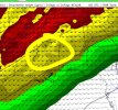
That's a nice, expansive warm sector to say the least and what month is it? SW West Virginia even gets into those 60s dews. Wild!12z Euro has a very expansive warm sector
View attachment 49619
Follow along with the video below to see how to install our site as a web app on your home screen.
Note: This feature may not be available in some browsers.
That's a nice, expansive warm sector to say the least and what month is it? SW West Virginia even gets into those 60s dews. Wild!12z Euro has a very expansive warm sector
View attachment 49619


Thats why you have a very expansive warm sector being depicted on the 12Z Euro. The first low ejects into the northeast and drags that 60s dew point tongue into Western West Virginia and 50s all the way up to western New York, but doesn’t scour it. Then it wants to form that second SLP.Safe to say 12Z Euro and 18Z GFS threw me for a loop as they now both show two sub 1000 mb SLPs one right after the other. No clue what to make of any of it.
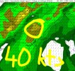
View attachment 49621
View attachment 49622
Always raises some alarm bells seeing succeeding low pressure systems like this in the south.Safe to say 12Z Euro and 18Z GFS threw me for a loop as they now both show two sub 1000 mb SLPs one right after the other. No clue what to make of any of it.
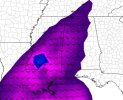
View attachment 49621
View attachment 49622
Why @UncleJuJu98Always raises some alarm bells seeing succeeding low pressure systems like this in the south.
Kind of reminding me of a handful of disparate, super conditional threats we've had in the past. Instances where, in theory, storms could become productive with instability, but greater dynamics have pulled away, leaving a relatively meager environment for storms to really get going. That's if it actually pans out like it currently looks, which is far from certain.Thats why you have a very expansive warm sector being depicted on the 12Z Euro. The first low ejects into the northeast and drags that 60s dew point tongue into Western West Virginia and 50s all the way up to western New York, but doesn’t scour it. Then it wants to form that second SLP.
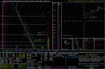
There’s little to no LLJ in place over the southern area at 18z yet though on the 12Z Euro. We’ll have to see if any appreciable instability can form in that area and which way the models start trending.
Yeahhh the more I look at it the more confused I feel about it. Verbatim, 18Z GFS would be a fairly typical evening/overnight Deep South scenario with what would likely be a small expanse of meager instability that is nonetheless sufficient for spinups. But I'm not sure I buy the actual large-scale evolution with 2 lows one-after-another (it can certainly happen, but just looks funky). At the same time, GFS suggests the first low will help bring in Gulf moisture ahead of the second system, and if GFS is still doing its global underestimating moisture return and instability, then it could improve the environment out ahead of our second low.Kind of reminding me of a handful of disparate, super conditional threats we've had in the past. Instances where, in theory, storms could become productive with instability, but greater dynamics have pulled away, leaving a relatively meager environment for storms to really get going. That's if it actually pans out like it currently looks, which is far from certain.


Just because of first low being a primer, always makes me think the atmosphere will be reach with moisture, and you don't really want to see that in the winter tornado season.


Thank for analysisA adequate sounding for brief tornadoes in S Mississippi after 21z. Some LLJ uptick is notable and instability will help. I feel like focus is gradually shifting south now. I would still watch that moisture return up north though but i am having questions if we really will see decent destabilization that far north. Winds a bit parallel to the front as they close in on MS so may be a damaging wind/tornado threat if storm mode remains persistent down there. Low level shear extends to W Central Alabama. The 18z GFS might not be the large, spatial scenario the Euro depicts but it is a closed in scenario on Mississippi/Alabama with clear damaging wind and spinup potential that is evident. Would keep weather radios on down there and i think we will see a decent shift down into these areas next outlook. I feel like even ensemble guidance is slowly shifting towards here too. I'm not sold on the northern portion due to a potential inversion that may limit storm development. Down south, we seem to have enough forcing to initiate evident by the parallel shear vectors. Quick spinup tornadoes can still be impactful so anyone in that Brookhaven-Jackson-up to Tuscaloosa vicinity needs to watch. I'm also curious if any confluence bands could develop. There may be a little chance based off a quick glance, but we'll see.
No problemThank for analysis