• Welcome to TalkWeather!
    We see you lurking around TalkWeather! Take the extra step and join us today to view attachments, see less ads and maybe even join the discussion.
    CLICK TO JOIN TALKWEATHER

Severe WX Severe Weather Threat: April 21-23, 2017

Bama Ravens

Member
Messages
1,207
Reaction score
649
Location
Morris, AL (Northern Jefferson County)
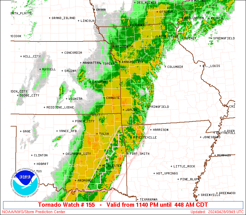
Looks like we have a potential threat for this weekend, so let's get a thread going.

Models continue to struggle with the details of the shortwave
trough/upper low moving from the Plains to the Tennessee Valley
this weekend, likely due to differences in its interaction with
the northern stream and especially the departing shortwave over
eastern Canada. The GFS has a more symmetric upper low/neutrally
tilted trough over Missouri on Saturday, eventually elongating
into a positively tilted trough over the area on Sunday, with a
slightly stronger surface low moving along the KY/TN border. The
latest ECMWF has a more extreme positive tilt/elongation to the
trough and a weaker surface low over TN. With the positive tilt in
either solution, the best upper-level forcing/deep layer shear
/mid-level cooling and associated mid-level lapse rates lag behind
the front, more so in the ECMWF than in the GFS. Will continue to
include just a low-confidence severe threat in the HWO, for a
low-end damaging wind and marginally severe hail threat. The
relatively greatest potential will be in the west/northwest
counties with 1000-1500 J/kg of CAPE and around 40 kts of 0-6 km
shear in the afternoon, decreasing further east due to less
instability after sunset though slightly greater shear. Veered
surface to 850 mb flow caused by the positive tilt of the trough
will limit the low-level SRH despite some low-level speed shear,
so the threat of a brief tornado continues to look too low to
mention in the HWO.
 

Taylor Campbell

Moderator
Moderator
PerryW Project Supporter
Messages
2,102
Reaction score
2,189
Location
Wedowee, AL
Special Affiliations
  1. SKYWARN® Volunteer
I was just about to start this thread. It's been on the GFS for 14 days, but the GFS still can't get it's mind right with exactly how to resolve it. The EURO has been all over the place too. Some ensemble members, and operational have supported a localized area of 4-7 SCP on Saturday. The trough axis moves onshore in the Pacific Northwest overnight tomorrow. It'll be interesting to see what they show then. There's a lot to still figure out with this one, but overall it looks to bring at least a slight risk of severe weather into the Southeast.
 

Kory

Member
Messages
4,928
Reaction score
2,119
Location
Tuscaloosa, Alabama
SPC outlined a region from North MS, Western TN into far NW AL for Saturday. Right now, hail/damaging winds are the primary threat with a few tornadoes as the secondary threat. It looks like A-Day is Tuscaloosa should end before the main round of storms makes it in.

I can't say I disagree with the SPC outlook at this time. Enough instability (1000-1500 J/KG) combined with 40-50kts of deep layer shear should support organized storms. Instability will pinch off with eastward extent so I'm not very confident a threat will persist into Eastern TN/Eastern AL/GA. And by then, best dynamics will lag behind the surface boundary.
 

pritchlaw

Member
Messages
84
Reaction score
101
Location
Warrior, AL
If it gets here a little earlier than forecast as of Wednesday morning, Alabama's A-Day may be a mess.
 

Kory

Member
Messages
4,928
Reaction score
2,119
Location
Tuscaloosa, Alabama
The supercell analog trigger on SHARPy is going bonkers for Saturday's threat. It does look cellular in nature, but we're gonna need some better speed shear for more sustained, organized convection. 40 kts of deep layer shear is on the lower end of things, but we shall see. Current thinking is TN/MS and Western/NW AL.

Edit for typo.
 
Last edited:

pritchlaw

Member
Messages
84
Reaction score
101
Location
Warrior, AL
This one looking weak for North Alabama.
 

warneagle

Member
Messages
3,729
Reaction score
3,208
Location
Arlington, VA
Special Affiliations
  1. SKYWARN® Volunteer
Small ENH over southeastern OK and north TX, may want to amend the thread title to include today.
 

Taylor Campbell

Moderator
Moderator
PerryW Project Supporter
Messages
2,102
Reaction score
2,189
Location
Wedowee, AL
Special Affiliations
  1. SKYWARN® Volunteer
The new day 2 makes much more sense. It could have been drawn that way days ago.
 
Messages
585
Reaction score
403
Location
St. Catharines, Ontario
This is looking like mainly a straight-line wind/large hail threat with a fairly low tornadic risk. The risk for tornadoes looks higher with the Plains area threat mid/late next week. Not that other severe threats can ever be discounted.

I remember in particular when my next door neighbour decided to ignore a severe thunderstorm warning a couple summers ago as a supercell was cruising over town. He didn't take the threat of hail seriously, since it's rare for us to get more than pea-sized hail up here in Ontario, and then was shocked when he went out to the store just to have his car pelted with golf ball-sized stones. He luckily wasn't injured.
 

Bama Ravens

Member
Messages
1,207
Reaction score
649
Location
Morris, AL (Northern Jefferson County)
AL_swody2.png
 
Messages
585
Reaction score
403
Location
St. Catharines, Ontario
New tor watch for SE Oklahoma/NE Texas/W Arkansas. 50/20 probs, so just slightly above the default.
ww0155_radar_big.gif

SEL5

URGENT - IMMEDIATE BROADCAST REQUESTED
Tornado Watch Number 155
NWS Storm Prediction Center Norman OK
440 PM CDT Fri Apr 21 2017

The NWS Storm Prediction Center has issued a

* Tornado Watch for portions of
western Arkansas
southeast Oklahoma
north centrtal and northeast Texas

* Effective this Friday afternoon and Saturday morning from 440
PM until 100 AM CDT.

* Primary threats include...
A few tornadoes possible
Scattered large hail and isolated very large hail events to 2
inches in diameter possible
Scattered damaging wind gusts to 70 mph possible

SUMMARY...A few supercells are expected to develop in vicinity of a
cold front and convectively reinforced boundary, and some storms may
evolve into line segments. Large hail, damaging wind and a few
tornadoes will be possible with this activity this evening.

The tornado watch area is approximately along and 110 statute miles
east and west of a line from 20 miles east northeast of Poteau OK to
45 miles south southeast of Fort Worth TX. For a complete depiction
of the watch see the associated watch outline update (WOUS64 KWNS
WOU5).

PRECAUTIONARY/PREPAREDNESS ACTIONS...

REMEMBER...A Tornado Watch means conditions are favorable for
tornadoes and severe thunderstorms in and close to the watch
area. Persons in these areas should be on the lookout for
threatening weather conditions and listen for later statements
and possible warnings.

&&

AVIATION...Tornadoes and a few severe thunderstorms with hail
surface and aloft to 2 inches. Extreme turbulence and surface wind
gusts to 60 knots. A few cumulonimbi with maximum tops to 500. Mean
storm motion vector 26035.

...Dial
 

Daryl

Member
Messages
316
Reaction score
99
Location
Boaz,AL
mcd0546.gif


Mesoscale Discussion 0546
NWS Storm Prediction Center Norman OK
1251 PM CDT Sat Apr 22 2017

Areas affected...Central Louisiana northeastward to northwestern
Alabama and Middle Tennessee

Concerning...Severe potential...Watch possible

Valid 221751Z - 221945Z

Probability of Watch Issuance...40 percent

SUMMARY...Damaging wind gusts and hail approaching 1" in diameter
are all possible with storms developing across the region this
afternoon. A WW is being considered.

DISCUSSION...Scattered thunderstorms are continuing to increase
across the discussion area just ahead of a surface boundary
extending from Middle Tennessee, through the Mississippi Delta, and
southwestward into northern Louisiana. The airmass ahead of this
frontal boundary was weakly capped, with insolation/surface warming
and weak low-level warm advection fostering weak to moderate
instability in an axis from central Louisiana northeastward to
Middle Tennessee. Stronger instability was common in southwestern
portions of the discussion area (1500-2000 J/kg MUCAPE), with
gradually weaker instability (500 J/kg MUCAPE) area near Nashville.
Westerly deep shear (around 35 knots) was sufficient for storm
organization, and weak surface convergence combined with ascent
associated with a mid-level low north of the area should foster
gradually increasing convective coverage and intensity with
progression toward peak heating later this afternoon. Hail and
gusty winds will be the primary threats with this activity.

Given the aforementioned scenario, a WW issuance is being considered
for portions of the region.
 

warneagle

Member
Messages
3,729
Reaction score
3,208
Location
Arlington, VA
Special Affiliations
  1. SKYWARN® Volunteer
Tornado warning in southern Virginia, since that's what everyone expected today.
 

MichelleH

Moderator
Moderator
Messages
861
Reaction score
1,181
Location
Cullman, AL
I noticed this morning SPC didn't have us in a tornado outlook and now we're in a 2%. Still not much, but it is April...
 
Back
Top