US_Highway15
Member
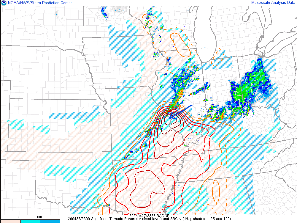
The severe weather threat for Tornado Watch 162 continues.
SUMMARY...Severe risk is increasing across portions of WW 162.
Strong tornadoes, very large hail and damaging gusts remain
possible.
DISCUSSION...Deepening cumulus and a few towering cumulus are noted
in GOES-16 DCP imagery recently. A couple of towers now have
lightning occurring over far southern IL. This activity is occurring
within an axis of strong instability (2500-3000 J/kg MLCAPE). The
VWP from KPAH also shows wind profiles favorable for supercells with
strong tornado potential, indicated by enlarged, looping low-level
hodographs and 0-1 km SRH over 250 m2/s2. Additional strengthening
of the nocturnal low-level jet is expected over the next couple of
hours. In tandem, forcing for ascent should increase across portions
of WW 162. This may support additional supercell
development/strengthening of current convective attempts in the
short term. Any storms the develop could strengthen and organize
quickly, posing a risk for very large hail and strong to intense
tornadoes.