Smokedevil
Member
Nothing confirmed yet, but they're trying awfully hard. We shall see.
Follow along with the video below to see how to install our site as a web app on your home screen.
Note: This feature may not be available in some browsers.

That first picture is extremely impressive.

I think that’s the remnant of the larger original watch area.also why is this one tornado watch so tiny?
View attachment 35983
ive honestly seen tornado warnings larger then that.
It’s nowcast mode, but there has been a more “broken line”, similar to last night’s look, to the past few model runs. Really interested in seeing the real time soundings in over the risk area.View attachment 35979
I seriously do not buy this. It makes no sense if the cold front still hasn’t moved much.

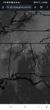
Not at all...still cloudy here in Pontotoc County, but i don't know how much longer it'll last.Side note. The sun is out here in Monroe county ms. Definitely not good.
Low clouds are racing to the north at breakneck speed.Not at all...still cloudy here in Pontotoc County, but i don't know how much longer it'll last.
Yeah I am fairly sure that cap is stronger than what was progged at least for this hour.Plenty of time to go, but I am kind of surprised at that moist layer depth. Also, capped.
View attachment 35986