• Welcome to TalkWeather!
    We see you lurking around TalkWeather! Take the extra step and join us today to view attachments, see less ads and maybe even join the discussion.
    CLICK TO JOIN TALKWEATHER

Severe WX Severe Weather Threat 3/14-3/16

Friday seems to be uptrending on the tornado threat. Places all the way up around Southern Illinois/Indiana might get in on some 60s dew points overnight. Could be a sneaky nocturnal QLCS event up there, with supercells possible to the south. Some PDS hodos now prevelant in Western KY/TN.
 
Last edited:
Personally speaking, I'm getting the feeling that Saturday could be a fairly high-end (roughly Moderate-High Risk) event, probably on the level of the likes of, say, 4/8/1998, 4/12/2020, and 3/25/2021. Most likely (and hopefully) not a super outbreak (unless things trend upward like a rocket--knock on wood!), but still a fairly notable event. At the very least, let's all pray that we get through Friday-Saturday with as little property damage and as few casualties as possible.
 
Been trying to pull NAM soundings for my own backyard and 18z and 00z are both contaminated, it's real 'fun' being reminded that oh yeah there will be convection in this environment

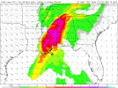
Nasty shear profiles overnight Friday too across north Alabama with quite a bit of capping; if anything manages to convect overnight (perhaps outflow boundaries from Friday storms to the west?) I can definitely see why SPC is considering highlighting more of N AL/N MS for that conditional threat
 
My take. SPC Day 3 wording for Friday doesn't give me any good feelings particularly that last part. Given this, Friday is definitely a contender for Level 4 Moderate Risk. Saturday is as well with High upgrade looking probable. NOW is the time to know where your safe place is, make sure you have multiple ways of getting warnings, etc.

Convection may develop later across AR into the TN Valley/Deep
South. However, deeper Gulf moisture will be in place across this
region (possible mid/upper 60s F). This will support stronger
instability amid supercell wind profiles. Large-scale ascent will be
more subtle across this area, but sharpening of the dryline across
AR and low-level confluence should support convective development
during the evening. Initial supercells may grow upscale into a line
moving across portions of AR/TN/northern MS/AL. An attendant risk of
strong tornadoes and swaths of damaging/potentially significant wind
gusts is expected across the Mid-South with this activity.

A more conditional risk for overnight supercells exists across parts
northern/central MS/AL. The environment could support intense
supercells capable of producing large hail and strong tornadoes this
far south, but forcing mechanisms will be weak. Trends will be
monitored and future outlook adjustments may be needed.
 
Back
Top