warneagle
Member
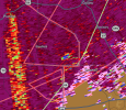
hasn't quite consolidated that low level rotation yet but if it does it could be a problemThis has the look of a troublemaker. Progged to move into NW Tuscaloosa County.
View attachment 36214
Follow along with the video below to see how to install our site as a web app on your home screen.
Note: This feature may not be available in some browsers.
hasn't quite consolidated that low level rotation yet but if it does it could be a problemThis has the look of a troublemaker. Progged to move into NW Tuscaloosa County.
View attachment 36214
Any mention of a QRT survey with that prelim?Cave city Arkansas tornado is already a confirmed 165mph EF3.
I remember seeing this on the models but it seemed the dewpoints dramatically increased right with the storms as they moved in.Feel like this gradient of dewpoints/pressure could cause some issues later for central ALView attachment 36217

Not yetAny mention of a QRT survey with that prelim?


There will be diurnal waning of instability, but a mixture of the LLJ, moisture return and the fact that it actually got sunny and warm over much of the region will mean that CAPE of >500 j/kg will be maintained across the area well after dark.The first frame of the HRRR run shows immense CAPE then, when simulated, it almost completely disappears within 2 hours. It has been doing the same thing the last 3 or 4 runs, even though the starting cape has gone up with each run. Basically, it's showing decreasing CAPE within an hour or two, but then the following runs are showing INCREASED CAPE, so it's failing to verify even an hour or two ahead. It's almost seems like it's getting confused with the amount of energy the system is pulling up from the gulf and can't correct itself. I hope I'm wrong though, and this is actually what we see.
View attachment 36211
View attachment 36212
We don’t need a lot of thermodynamics to produce significant tornadoes for TN. I know it seems that way but unfortunately I do think it will verifyMiddle TN could just never recover from this morning’s rain. Maybe had an hour or two of sunlight. I would be very surprised if anything verified within the watch zone. Possibly extreme south TN.