• Welcome to TalkWeather!
    We see you lurking around TalkWeather! Take the extra step and join us today to view attachments, see less ads and maybe even join the discussion.
    CLICK TO JOIN TALKWEATHER
Logo 468x120

Severe WX Severe weather thread March 5th-7th, 2022

bwalk

Member
Messages
597
Reaction score
291
Location
Prattville, Al
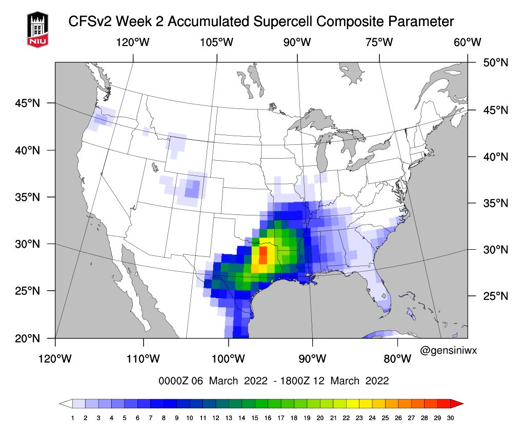
The hotspot for severe weather next week looks to be generally centered in the Ark-La-Tex sector based on the current NCEP model.

 
Messages
3,081
Reaction score
5,417
Location
Madison, WI
SPC Day 4 area expanded to include even more of Iowa, parts of southwest Wisconsin and western Illinois. A bit optimistic IMO given the paltry instability forecasts, but definitely bears watching. Day 5 area added centered on Arkansas.
 

Fred Gossage

Member
PerryW Project Supporter
Meteorologist
Messages
787
Reaction score
3,620
Location
Florence, AL
SPC Day 4 area expanded to include even more of Iowa, parts of southwest Wisconsin and western Illinois. A bit optimistic IMO given the paltry instability forecasts, but definitely bears watching. Day 5 area added centered on Arkansas.
I think we're eventually going to end up with a risk flagged for Monday as well. GFS, Euro, and ensembles have slowed down with the system over the past 24-36 hours, and it's now coming through MS/AL/TN during that late morning to mid evening timeframe. GFS/Euro has anywhere from 700-800 to 1500-2000 CAPE in the warm sector, and mid-levels are dry this time with adequately cold 500mb temps and 300mb temps near -40C. There's not an overly strong surface low, but there are hints that the pressure trough along the front could either have pressure falls that "act" like there's a secondary surface low over TN/KY, or there may actually be a secondary low develop, given the placement of the trough in relation to the frontal boundary. The past few events, as is often the case, low-level winds have verified less veered than what models show up until the last moment, but even if that's not the case, we have a 50-55 kt 850mb jet and 0-1 km SRH of 200-300 being modeled. I don't think it's a major event, but I see an organized lower-end day coming out of this with a SLGT Risk and tornado watches. Discrete/cell clusters may even be the main convective mode unless there is storm interaction closer to the front.
 

Clancy

Member
Messages
4,005
Reaction score
7,713
Location
Macland, Georgia
D4 up for parts of the southeast.
On Monday/D4, a positive-tilt upper trough will be over the central
Plains, with a larger-scale trough across the West. This lead wave
with 100+ kt midlevel speed max will rapidly move northeast across
the OH Valley with a broad region of west/southwest winds aloft
across the Southeast.

At the surface, an elongated area of low pressure will be situated
near the OH River, with mid 60s F dewpoints as far north as western
TN, and upper 60s F over MS and AL. Although the low will shift
northeast with time, storms are likely along the cold front as it
moves across the lower MS and TN Valleys. The combination of ample
moisture and strong winds aloft will result in damaging wind
potential despite MUCAPE values around 500 J/kg. Wind speeds around
850 mb will average 40 to 50 kt, and will result in favorable
low-level shear for a tornado threat as well, perhaps QLCS.

day4prob.gif
 

Brice Wood

Member
Messages
295
Reaction score
181
Location
Virginia
Plenty of inflow getting sucked up, nothing near it, this thing could go much longer like it already has
 
Back
Top