WeathermanLeprechaun
Member
The SPC has outlined a 10% CIG1 for portions of the extreme upper NE today. This is a late thread because for some odd reason, nobody has made a thread about this. Not that I like to make them given the incidents of my last thread, but this is a potentially notable day so here we go.
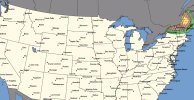
New England..
Morning water vapor imagery shows a belt of 80+ knot mid level winds
nosing from eastern Ontario into Quebec, with mid-level height falls
and large-scale forcing spreading into northern New England. This
has been aiding in multiple rounds of intense thunderstorms over
Quebec this morning, but so far this activity has struggled to make
it into the US due to a more stable air mass. This will change
through the day as a moist and moderately unstable air mass advects
eastward into parts of New England ahead of the primary convective
activity. Widespread smoke from upstream fires will also somewhat
limit daytime heating today, although the extent of the cooling is
uncertain.
Present indications are that several convective cells and clusters
will track southeastward across parts of eastern NY, VT/NH and
western ME later this afternoon and evening. Forecast soundings in
this region show favorable CAPE/shear combinations for supercell
storms capable of damaging winds, large hail, and a few tornadoes.
Larger bowing clusters may also evolve, with a greater risk of
damaging winds. This activity may persist after midnight with a
continued severe risk.
New England..
Morning water vapor imagery shows a belt of 80+ knot mid level winds
nosing from eastern Ontario into Quebec, with mid-level height falls
and large-scale forcing spreading into northern New England. This
has been aiding in multiple rounds of intense thunderstorms over
Quebec this morning, but so far this activity has struggled to make
it into the US due to a more stable air mass. This will change
through the day as a moist and moderately unstable air mass advects
eastward into parts of New England ahead of the primary convective
activity. Widespread smoke from upstream fires will also somewhat
limit daytime heating today, although the extent of the cooling is
uncertain.
Present indications are that several convective cells and clusters
will track southeastward across parts of eastern NY, VT/NH and
western ME later this afternoon and evening. Forecast soundings in
this region show favorable CAPE/shear combinations for supercell
storms capable of damaging winds, large hail, and a few tornadoes.
Larger bowing clusters may also evolve, with a greater risk of
damaging winds. This activity may persist after midnight with a
continued severe risk.