• Welcome to TalkWeather!
    We see you lurking around TalkWeather! Take the extra step and join us today to view attachments, see less ads and maybe even join the discussion.
    CLICK TO JOIN TALKWEATHER

Severe Weather May 31st- June 4th, 2018

Messages
267
Reaction score
226
Location
Smoke Rise, AL (25 mi. N of downtown Birmingham)
Severe_TWatch.png


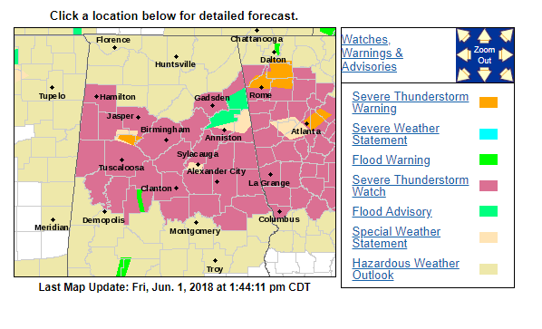
What's up with the dip in the watch area across Franklin, Cullman, and Blount Counties? Odd configuration. Could this be an error? Aren't they usually issued as rectangular shaped boxes?
 
Messages
267
Reaction score
226
Location
Smoke Rise, AL (25 mi. N of downtown Birmingham)
Watch box description below. How would those counties be left out?

The severe thunderstorm watch area is approximately along and 55
statute miles north and south of a line from 45 miles northwest of
Tuscaloosa AL to 40 miles northeast of Macon GA. For a complete
depiction of the watch see the associated watch outline update
(WOUS64 KWNS WOU4).
 
  • Thread starter
  • Moderator
  • #24

Taylor Campbell

Moderator
Moderator
PerryW Project Supporter
Messages
2,102
Reaction score
2,189
Location
Wedowee, AL
Special Affiliations
  1. SKYWARN® Volunteer
The enhanced was dropped.
 

akt1985

Member
Messages
1,009
Reaction score
510
Location
Madison, Alabama
I didn’t think there was a risk of severe storms in South Georgia and north Florida but there is as a Severe Thunderstorm Watch is in effect for that region.
 
Messages
179
Reaction score
59
Location
Adel, Ga
NWS Tallahassee recently issued a svr tstorm warning for 80 mph winds

The National Weather Service in Tallahassee has issued a

* Severe Thunderstorm Warning for...
East central Lowndes County in south central Georgia...
Southeastern Lanier County in south central Georgia...

* Until 345 PM EDT.

* At 326 PM EDT, severe thunderstorms were located along a line
extending from 8 miles northwest of Homerville to 6 miles east of
I-75 At Exit 16, moving east at 25 mph.

These are very dangerous storms.

HAZARD...80 mph wind gusts.

SOURCE...Radar indicated.


rolltide_130

Member
Messages
828
Reaction score
378
Location
Harvest, Alabama
Special Affiliations
Bit surprised there's been no mention of the absolutely dazzling lightning display S of Huntsville last night. Classic instance of a storm making its own CAPE environment higher than the actual surrounding area due to tracking right along the Tennessee River and tapping into those locally enhanced dewpoints. Some of the most frequent lightning I've seen in this part of the country - usually displays such as these are reserved for the Plains and Upper Midwest.

Some photos I captured of it:

34133604_1012740838894936_7772658373484347392_o.jpg


34383741_1012740902228263_2293988710498172928_n.jpg


34119735_1012740865561600_5976262957330333696_o.jpg
 
Back
Top