• Welcome to TalkWeather!
    We see you lurking around TalkWeather! Take the extra step and join us today to view attachments, see less ads and maybe even join the discussion.
    CLICK TO JOIN TALKWEATHER

Severe Weather 3-25

Off topic, but not used to severe weather threads being this quiet.
I think the limiting factors (or potential bust-ness) are preventing a ton of attention, which I guess is fair.
 
I think the limiting factors (or potential Forecasted Convective Amplification Deficiency-ness) are preventing a ton of attention, which I guess is fair.
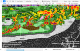
Yeah I mean this one's tough. IWX says that they think the cap will remain in place, but HRRR has some showers rolling through before the main event (or supposedly). Still mostly sunny here right now. Haven't seen the sun go behind the clouds yet.
 
Yeah I mean this one's tough. IWX says that they think the cap will remain in place, but HRRR has some showers rolling through before the main event (or supposedly). Still mostly sunny here right now. Haven't seen the sun go behind the clouds yet.
My main concern is exactly that, although I'm terrible at forecasting so I didn't point it out - those showers will suck up and kill any significant threat for severe weather at least in the IL portion and probably further east. Imagine a localized and less-potent version of 3/16.

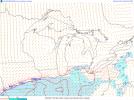
The COD website's sounding generator is currently broken but based off (the incredibly laggy) Pivotal Weather, soundings in N Ohio have downtrended slightly, at least from what I've pulled.
 
...THERE IS AN ENHANCED RISK OF SEVERE THUNDERSTORMS ACROSS PARTS OF
THE MIDWEST/OHIO VALLEY...

..SUMMARY

SCATTERED SEVERE THUNDERSTORMS ARE EXPECTED THIS AFTERNOON AND
EVENING ACROSS PARTS OF THE MIDWEST AND OHIO VALLEY. LARGE TO VERY
LARGE HAIL, A FEW TORNADOES, AND SEVERE/DAMAGING WINDS ALL APPEAR
LIKELY.

..MID MISSISSIPPI VALLEY INTO THE MIDWEST/OHIO VALLEY


WATER-VAPOR IMAGERY LATE THIS MORNING SHOWS A FLATTENED UPPER RIDGE
CENTERED OVER THE SOUTH-CENTRAL U.S. WITH STRONG WESTERLY
MID/UPPER-LEVEL FLOW ACROSS THE MIDWEST/GREAT LAKES. A MID-LEVEL
SHORTWAVE TROUGH OVER THE NORTHERN ROCKIES WILL MOVE QUICKLY
EAST-SOUTHEAST INTO THE UPPER MIDWEST AND ACT TO SUPPRESS MID-LEVEL
HEIGHTS ACROSS THE MIDWEST/GREAT LAKES THROUGH TONIGHT. SURFACE
ANALYSIS THIS MORNING SHOWED A WEAK LOW OVER EASTERN IA WITH A
WEST-EAST ORIENTED FRONTAL ZONE EXTENDING EAST ACROSS THE SOUTHERN
GREAT LAKES. IF A WEAK SURFACE REFLECTION IS MAINTAINED AND
DEVELOPS EAST ACROSS THE SOUTHERN GREAT LAKES THROUGH THIS EVENING,
IT MAY NOTABLY INFLUENCE SEVERE POTENTIAL WITHIN A FOCUSED CORRIDOR
LATE THIS AFTERNOON THROUGH THIS EVENING. THE AFOREMENTIONED FRONT
WILL GRADUALLY PUSH SOUTH AND SERVE AS THE PRIMARY IMPETUS FOR STORM
DEVELOPMENT.

BENEATH A CAPPING INVERSION, MOISTENING WILL CONTINUE WITH SURFACE
DEWPOINTS RISING INTO THE 56-62 DEG F RANGE FROM THE MID MS VALLEY
EAST INTO WESTERN PA. UPWARDS OF 500-1500 J/KG MLCAPE IS LIKELY BY
MID AFTERNOON SOUTH OF THE FRONT. A BELT OF STRONG, WESTERLY 50-65
KT 700-MB FLOW IS FORECAST TO MOVE FROM IA AND EXPAND SPATIALLY
ACROSS THE WARM SECTOR THROUGH EARLY EVENING. THIS INCREASE IN FLOW
WILL ACT TO ELONGATE HODOGRAPHS DESPITE MAINLY VEERED SOUTHWESTERLY
SURFACE FLOW. RECENT CONVECTION-ALLOWING MODEL GUIDANCE VARIES
CONSIDERABLY ON THE DEPICTION OF CELLULAR VERSUS MOSTLY LINEAR
CLUSTERS EVOLVING IN THE FIRST FEW HOURS OF THE CONVECTIVE LIFE
CYCLE. TIME-LAGGED HRRR WOULD IMPLY A MORE SPATIALLY AND
NUMERICALLY EXTENSIVE SUPERCELL HAIL AND TORNADO RISK THAN MOST OF
THE 12Z HREF HRW MEMBERS SHOWING LESS RISK OF THESE HAZARDS. THE
TORNADO RISK COULD FOCUS WITH POTENTIAL SUPERCELLS NEAR A WEAK LOW
AND WHERE SURFACE FLOW WOULD LOCALLY BACK TO SOUTHERLY. HOWEVER,
CONFIDENCE IS MUTED REGARDING THIS SPECIFIC SCENARIO.

REGARDLESS, CURRENT EXPECTATIONS ARE FOR THUNDERSTORMS TO QUICKLY
DEVELOP ALONG THE LENGTH OF THE FRONT FROM CENTRAL IL EASTWARD INTO
IN, SOUTHERN LOWER MI, AND NORTHERN OH BY 19-22Z AS DIURNAL HEATING
ERODES LINGERING CONVECTIVE INHIBITION. A MIX OF SUPERCELLS AND
ORGANIZED LINEAR CLUSTERS WILL EVOLVE WITH LARGE TO VERY LARGE HAIL
POSSIBLE. A FAIRLY QUICK TRANSITION TO MORE LINEAR STRUCTURES
APPEARS LIKELY GIVEN THE FRONTAL FORCING, WITH AN INCREASING THREAT
FOR SCATTERED TO NUMEROUS SEVERE/DAMAGING WINDS AS ONE OR MORE
CLUSTERS SPREADS EAST-SOUTHEASTWARD ACROSS MUCH OF THE OH VALLEY
INTO WESTERN/CENTRAL PA THROUGH THE LATE AFTERNOON AND EVENING.
GIVEN THE FORECAST STRENGTH OF THE LOW TO MID-LEVEL FLOW, ISOLATED
GUSTS OF 75+ MPH MAY OCCUR. THERE IS A THREAT FOR A FEW TORNADOES
AS WELL WITH BOTH SUPERCELLS AND EMBEDDED MESOCIRCULATIONS WITHIN
THE LINEAR CLUSTERS.
 
This is a day with a higher ceiling than the previous setup, but also is more likely to not pan out IMO. The shear profiles are quite concerning and strong tornadoes are possible if a storm is able to remain discrete enough and become surface based. I think it’s more likely we see a large wind bag with embedded hail cores though.
 
. RECENT CONVECTION-ALLOWING MODEL GUIDANCE VARIES
CONSIDERABLY ON THE DEPICTION OF CELLULAR VERSUS MOSTLY LINEAR
CLUSTERS EVOLVING IN THE FIRST FEW HOURS OF THE CONVECTIVE LIFE
CYCLE. TIME-LAGGED HRRR WOULD IMPLY A MORE SPATIALLY AND
NUMERICALLY EXTENSIVE SUPERCELL HAIL AND TORNADO RISK THAN MOST OF
THE 12Z HREF HRW MEMBERS SHOWING LESS RISK OF THESE HAZARDS. THE
TORNADO RISK COULD FOCUS WITH POTENTIAL SUPERCELLS NEAR A WEAK LOW
AND WHERE SURFACE FLOW WOULD LOCALLY BACK TO SOUTHERLY. HOWEVER,
CONFIDENCE IS MUTED REGARDING THIS SPECIFIC SCENARIO.
 
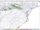
Nadocast thinks the greatest tornado threat will be with the cluster of cells up near Mansfield:
1774542485469.png
 
This is a day with a higher ceiling than the previous setup, but also is more likely to not pan out IMO. The shear profiles are quite concerning and strong tornadoes are possible if a storm is able to remain discrete enough and become surface based. I think it’s more likely we see a large wind bag with embedded hail cores though.
Yeah, the concerning part is that the storms are moving east and could become undercut.
 
Ohio might be the main show
Boo-yah. I won't be out chasing today unfortunately (don't have a partner and I don't want my first chase to be a nocturnal clusterfest) but luckily it seems the weather might come to me in the Columbus metro.
 
New AFD from IWX:

".DISCUSSION...
Issued at 105 PM EDT Thu Mar 26 2026

Severe parameters still appear favorable for scattered severe storms
mid afternoon into early this evening along a southward sinking
frontal zone. For buoyancy, ongoing low level theta-e advection and
heating under an EML will support ~1500 j/kg of MLCAPE. Updraft
maintenance and growth shouldn't be a problem given deep layer shear
magnitudes in excess of 50 kts. Low level southwest flow will also
strengthen into the frontal zone increasing hodograph curvature and
0-1/3 km SRH values. All hazards (hail/wind/tor) remain on the
table, with large hail and damaging winds the primary threats. Only
change today has been for slightly quicker start and end times of
the convection.

As for forcing, timing and convective evolution... An incoming
subtle mid level impulse and associated 700/500 mb speed max
still looks to be enough to break through the strong EML capping
inversion around 21-22z. Anything before this will likely
struggle to do anything more than small hail. Deeper convection
likely initiates in nw IN and ne IL near the lake breeze
augmented portion of the front where sfc temps are forecast to
range from the mid 40s along the lakeshore to low-mid 80s just
inland. Progged shear/instability profiles mentioned above
should allow for scattered supercells to develop with large hail
probably the main threat initially along/north of the US 24
corridor. Mergers and upscale growth is then expected into
eastern/southern portions of the forecast area 22-02z with
probabilities for damaging winds to 70 mph, large hail, and
isolated tornadoes increasing in this time window. A transition
to more of a hydro threat then remains possible mid evening
through the early overnight, mainly along and south of the US 24
corridor. Convection, hopefully non-severe by this point,
likely fills in as deep layer forcing increases over the
elevated portion of the front where precipitable water values
briefly pool up to 1.50 inches."
 
Back
Top